My goal is for this to evolve into the definitive bike
up Haleakala web page on the 'net, partly because I like to encourage
people to explore places by bicycle, and partly because it gives me
an excuse to go back again to make sure my info remains accurate!
--Mike--
06/29/10-
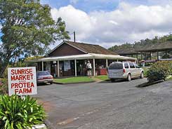
Hey Mike, The Sunrise market went out of business
about two months ago, so the last market is about a mile down
the hill, called Kula Marketplace, just before you turn onto the
Haleakala Highway/Crater Road. Sent from Andrew's iPad
05/03/13- Hello Mike, I used your valuable
website in the planning of my Haleakala Bicycling Adventure and
I would be pleased and proud if you linked my slideshow there.
Have a look: http://www.youtube.com/watch?v=Z9cWn3pHTGA
Like you I want to inspire and share. Thank you! Tom
It's just
a hill, in the grand scheme of things. Only different. Not because
it's 10,023ft at the summit, but because this is one of those rare
mountains that you can literally start at sea level... well, not
just sea level, but actually at the sea! You don't have to do the
ride that way though; you can start at the base of Highway 37 (near
the airport), and pretty much eliminate the chance of taking a wrong
turn and adding another 1700ft to the climb. But what's the fun in
that?
So, with a customer's admonition that I had no choice to but
literally start at the Ocean, my wife & I got up at 6am (thankfully,
that's 8am California time, and we had just arrived the night
before) and drove out to Paia. From Kihei (South Maui), it's only a
half-hour drive, so after showers, breakfast etc., we got to Paia
about 7:45am. Some say that's getting too late a start, but not
really sure why; the sun isn't too bad yet, and to try and beat the
temp & humidity you'd pretty much have to start in the dark.
On the other hand, you're looking forward to an unbroken 38 miles of
climbing. Totally unrelenting, with the only opportunities to rest
being those you make for yourself. And you really don't know
how long it will really take. You've read everything you can
find on the Internet about the mountain, and find that the record is
something just under 3 hours, and that pretty strong riders typically
finish in about 5, with many taking a full 8 hours to get up there.
Elevation profile, heart rate & temps along the way...
Yeah, I know, skip the pictures and descriptions, what you really
want to see is a printout showing the particulars of the climb. How
long, how steep, that sort of thing. Well, truth is, were it not for
the missed turn I took, the graph would be pretty darned boring!
Haleakala, as you can see in the graphic on the right (which will
enlarge quite nicely if you click on it) just goes up... and down.
Still, you can get an idea what the effort's like by checking out my
heart rate during the climb, and noting the relatively-natural
places you can choose to break the ride up into
psychologically-manageable chunks.
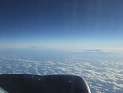
Sunday, November
20th, 5:31pm. My first glimpse of Haleakala comes from the plane
as we head into Honolulu, where we caught a connecting flight to
Maui. My bike made it without a scratch.
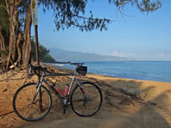
Monday, 7:50am.
According to John L, one of our customers, you're not allowed to
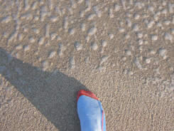
start this ride anywhere but at the ocean, and it must include a
mandatory toe into the sea.
Guess that's what a ride from "sea level" is all about? Got to admit
my bike liked that beach; you can see how happy it looks in the
photo! Was it worth sand in my socks and fouling my Speedplay cleats
for? Definitely.
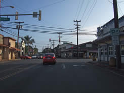
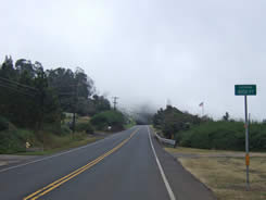
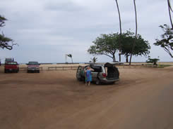
7:58am. Downtown Paia, a good place to start this ride. Why?
Because it sits right on the ocean. Otherwise it didn't look that
interesting to me.
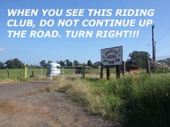
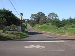
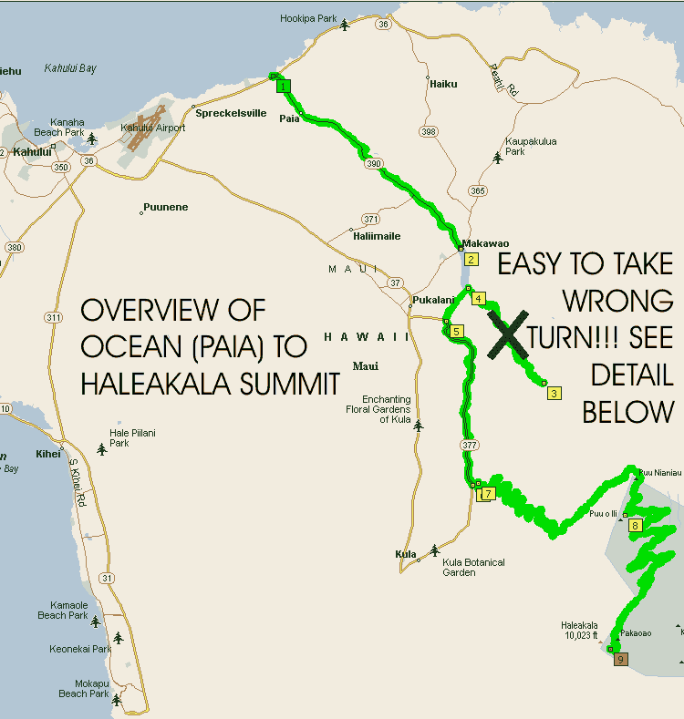
8:37am. This is
your first opportunity to get confused, in the town of Makawao,
7.1 miles into the ride. At the
intersection with the Mexican food stand, continue straight.
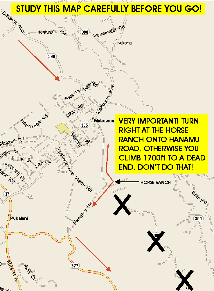
8:44am.
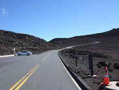
8.12 miles into the ride. This is where you turn right,
onto Hanamu! Please study the detail map at the bottom of this
page. Very important!
8:44am.
IT'S STEEP, AND IT'S THE WRONG WAY!!!
If you encounter a 10% grade, you've made a wrong turn.
9:23am. If you screwed up, you
end up here. Dead End Road. Nearly 4 extra miles and
1700ft. Yeah, I screwed up.
9:29am. Nice view coming back
down, and a reminder that this was far steeper than anything
else on this ride.
9:38am. Back where you started
from, having wasted nearly an hour and adding 1700ft to the
climb. You're not feeling good about making it to the top right
now.
For the rest of the ride, you'll be thinking that you could
have been 1700ft further up the hill than you are. I (gasp) even
thought about giving up and trying again on a different day!
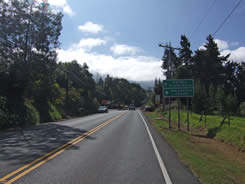
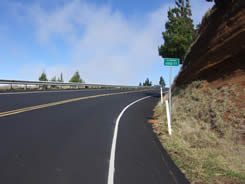
10:18am. Back on-route, having passed through
the small town of Kula and about to make the left turn onto Crater
Road. There is no possible way to mess up now,
unless you forget to
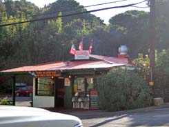
stop at the Sunrise Market
(8/4/12 Andy sent this email- The Sunrise
market went out of business about two months ago, so the last market
is about a mile down the hill, called Kula Marketplace, just before
you turn onto the Haleakala Highway/Crater Road.)
It's just a couple minutes after making the turn
onto Crater Road, and I used the opportunity to try and collect my
wits and pretend that those extra 1700ft were no big deal. It was a
good opportunity to take a break from riding; 25 minutes worth in
fact. Downed a Pepsi, a bag of Hawaiian potato chips and took apart
& cleaned my Speedplay cleats (they didn't like their encounter with
the sandy beach).
10:47am. Back on the road again,
the 3500ft sign being just past the Sunrise Market. Do remember to
stop there; it's not worth the risk of running on empty.
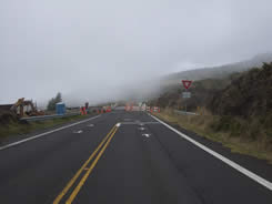
10:57am. 4000ft sign, and for
the first time, you're going to directly encounter the weather.
Pretty low-hanging cloud, not what I expected!
11:46am. Too bad I didn't have
the presence of mind to take photos of the zillions of switchbacks
making their way up the hill behind me.
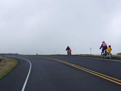
11:50am. Yes, you'll see quite a
few people "cruising" down Haleakala, in big fluffy jackets on cheap
mtn bikes & cruisers. For this they pay $90-$120, getting up at 2am
to watch the sunrise.
11:55am. Heading down the hill
with trail-a-bikes in tow? Not my idea of a good time! The descent,
I'd later discover, is almost mind-numbing in length. In a way, it's
easier going up than down!
11:59am. 6500ft. Where did all
the other elevation signs go? Still, 2500ft in one hour isn't too
bad (normal pace would be 3000/hour), so I'm thinking I'm OK.
Delusion setting in already!
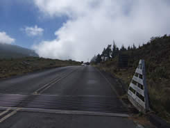
12:05pm. Cattle guards,
normally no big deal, somehow seem more annoying than they should
when hit on a long climb! Fortunately there are only three of them.
12:05pm.
At last, there's hope! The park entrance, where a woman with a
strong Wisconsin accent awaits your $5 fee. Yes, even for bikes.
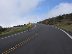
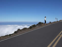
12:15pm. 7000ft, 33.03 miles.
Well, only 25 miles for those of you who don't miss the turn! The
clouds take on a life of their own, moving close & away from the mtn.
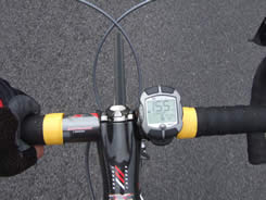
12:15pm.
This is the first ride where my HAC4 has been significantly off.
We're reading 6742ft instead of 7000, and by the top we're off by
456ft. Don't know if it's weather related or my computer's getting
goofy.
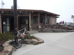
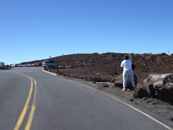
12:18pm. The ranger station
made a great (20 min) pit stop, with a rest room big enough to bring
your bicycle into! However, I saw no sign of anything (food or
water) to buy, contrary to what the woman at the entrance station
had said.
1:02pm. 8000ft, 36.64miles (28.5
for you slackers who didn't do the extra loop!) into
the ride. Trees are gone; you didn't notice it happen, probably
because you were in a fog, both figuratively and literally.
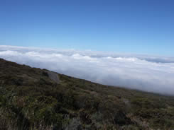
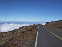
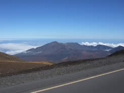
1:03pm-1:26pm.
You're now completely above the reach of the clouds, and if you look
way up the hill, you think you might be able to see... nope. Almost
the entire route seems designed to keep you from seeing the top.
Doesn't matter; what you can see is spectacular.
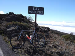
1:32pm. 9000ft, but I'm reading
8580 on my HAC4. 5:36 total time since leaving the ocean. Heart
rate's been tough keeping down to a sustainable level.
1:33pm. At 9000ft I stop for
the final time before the top. What I've found is that I climb a lot
faster, ironically, if I stop and get my heart rate back down. It's
frustrating because your pulse just gradually climbs back toward the
red zone, and once there, seems like no matter how much you throttle
back, it doesn't came back down. But the 12 minutes I spent here
were well-used, munching a powerbar and admiring the view.
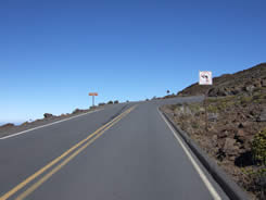
1:46pm. The sign ahead says
"Summit 2 miles." You're wondering, is it a cruel joke, or simply
cruel? It's the ultimate "So near, and yet so far..." At 9175ft,
there's still another 850ft to go!
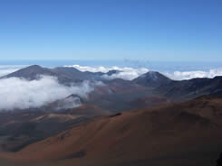
2:01pm.
About 9700ft, and the end is now in sight, at the upper-right of
this photo. Some liken the end of the climb it to the final part of
Mt. Diablo, but it's not even close to that steep.
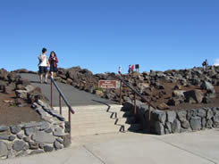
2:04pm-2:07pm.
The quarter-mile between these photos isn't easy, as the grade kicks
up to around 8% leading into the summit parking lot. The views are
spectacular, but first there's business to attend to- at the far end
of the parking lot is the paved walkway to the very top.Then
you can rest and admire the view!
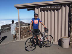
2:09pm.
Finally at the top! 6hrs 13 minutes from the bottom, including the
extra 1700ft and 7.75 miles that I rode just so I could say I
did the "tough" version of the ride, instead of the wimpy little run
up the hill. 11,844ft total climbing, 43.23 miles so far. Normally
you'd be at 10,023ft of climbing and 35.5 miles. By this time I'd
entirely forgotten what an idiot I was for missing that turn at mile
8.
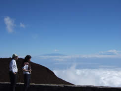
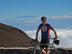
2:15pm-2:30pm. Pretty unbelievable how spectacular the
views are up here. I couldn't have asked for a much nicer day for
the ride, and am very glad I didn't wait a day or two, as rain began
to move into the area Tuesday evening. My guess is that, with a
four-day window to ride, you'll probably get at least one very nice
day. Don't miss it!
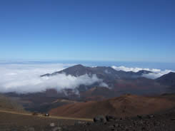
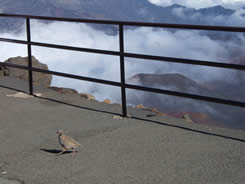
2:30pm-2:37pm. The sign in the left-hand photo says
"High elevation, walk slowly." Doesn't say anything about riding
though! Truth be told, the altitude didn't seem to be an obvious
factor, or at least not bothersome. The middle photo shows the old
Haleakala crater, and to the right is my first encounter with the
native Nene, a bird that you see signs everywhere warning you not to
run them over, but the birds themselves? Nowhere to be seen...
except at the top of Haleakala. (6/11/07- Dick H sent me an email
that the bird in fact is a Grouse)
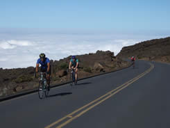
2:37pm. On the way down, I
finally saw a few cyclists also clawing their way to the top. They
were actually having a pretty good time, laughing and joking around.
Sign of oxygen deprivation?
3:13pm. Let me be the first to
tell you, the descent is not a whole lot of fun. Fog sometimes cuts
visibility to near-zero, and it's not steep enough to get any real
speed. Truthfully, the climb was more fun!
4:20pm.
Back in Paia! No, I didn't dip my toes into the water this time, but
I did get into a shower as quickly as I could back at the hotel!
11,844ft of climbing, 78.69 miles, 8 hours, 19 minutes start-finish.
Click on the map above for the
Google Maps routing (Google Maps didn't exist at the time I put
this together).
If you click on the map above, you'll
get a
Google Maps link showing you the extra part of the ride, the
part you do not want to do!
Final observations &
words of wisdom-
Allow yourself a
4-day window for doing this ride.
Rain is common in Hawaii, but over
any 4-day period, it's likely you'll have at least 1, and probably 2
nice days. You may not have a choice but to experience nasty, cold
conditions at higher elevations (from about 6500ft up), but your
ride will be a whole lot nicer if the first 2-3 hours aren't in
rainy conditions. Sure, it will be a relatively warm rain, but if
you have a choice, choose a dry day. Here's the link for weather at
the base of the climb (Paia)-
http://www.srh.noaa.gov/data/forecasts/HIZ020.php?warncounty=HIC009&city=Paia
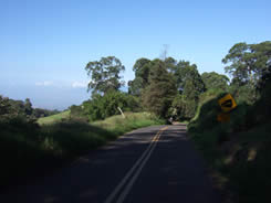
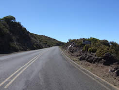
Haleakala isn't very steep, with the exception of a brief piece just
past the town of Makawao (shown on the map above) and the final
stretch at the very top. It doesn't take an
incredibly-strong rider to handle the hill, nor does it take
exceptionally-low gears. What it does take is patience... a
lot of patience, since this thing just goes and goes and
goes... and an ability to pace yourself and maybe take a couple of
rest stops, even though back home you'd throw yourself off a cliff
before stopping on a hill. Breaking this ride up into chunks (of
approximately 3500ft each) makes it seem a lot easier. The "extra"
stop at 9000ft can be excused just because it's so darned beautiful
up there.
There is no food available anywhere past
the Sunrise Market (#7 on the upper map), on the lower
section of Crater Road. Do not pass up the opportunity to buy a
drink, maybe some food, and take a breather there before you
continue! It's still over 6500 feet of climbing from there to the top, and
3500ft to the Ranger Station.
Most likely you won't need to stop before you get to Sunrise Market,
especially if you don't take a wrong turn like I did!
Water is available at numerous places below
Sunrise Market, but from there-up, only at the Ranger Station,
so be sure to carry two full bottles with you. You'll probably go
through water more quickly at the lower elevations, due to heat &
humidity, but the faster breathing at higher altitudes also requires
much more water than you'd otherwise need.
The ride back down the mountain is going to
take a lot longer than you'd think, partly because the
road isn't very steep, and partly because the corners of the
switchbacks are "flat" (not banked). It's really not much fun,
especially when you have to pedal hard to keep up enough speed so
that cars stay behind you. You hear about people seriously injuring
themselves on the downhill cruiser runs; my guess is that they must
get bored and fall asleep! On the other hand, the weather got quite
a bit gloomier across the middle of the mountain on the way down,
and that might have affected my thoughts about it, especially since
I had to put on a jacket that was flapping about in the wind.
Long-fingered windproof gloves,
or, at the very least, waterproof external gloves that fit over
your standard ones
Tights or leg warmers
Base layer
Waterproof windbreaker
You won't need much, or possibly any
of these for the climb up, but the top can be very, very cold, and
the descent through the clouds will be much more pleasant if you're
prepared.
In addition, you
should bring-
Cash. $5 for the park entrance
fee (in 2005; it could be more by the time you read this), plus whatever you might buy at Sunrise Market. Since it's
always possible you could run into trouble (due to weather or
whatever), carrying a couple 20s might not be a bad idea in case
you had to bribe someone for a ride down the hill, or food or
water.
Lots & lots of food. Some bring
sandwiches, but it seems like I'm reading quite a few reports of
people who thought a couple of PB&Js (peanut butter & jelly) would
do the trick, but didn't. I brought along 7 or 8 powerbars
(actually, my preference runs to Cliff Mojos and Powerbar
TripleThreats) and ate maybe 5 or 6. There's no reason to take a
chance on running out of fuel!
Cytomax (or whatever sports drink
works for you). Plain water might not be enough to keep cramps
away, especially on a climb as long as this one. Ideally something
you like the taste of, since that will encourage you to drink
more. I brought along enough for 4 extra bottles (beyond the two I
started with), easily done by scooping out the appropriate
amount of dry Cytomax mix into 4 separate plastic baggies.
Heart-rate monitor. Not a bad
thing to consider, since it will help you to keep from overdoing
it, and allow you to recognize signs of trouble. I've used a
heart-rate monitor for several years, but this was the first time
I've ever needed it for regulating my effort on a long climb. I'm
very glad I had it with me.
Camera. You'd be killing yourself
to know you left it at home if it's a nice day up on top. Heck, I
was wishing I had my full-blown DSLR rig (and very briefly
considered it bringing it with me in a backpack, but thank
goodness common-sense prevailed, and I brought my Fuji F10
instead).
Tylenol, Advil, or whatever your
painkiller-of-choice. Some people
get headaches at altitude, while others may simply need something
to dull the pain from all that time on the saddle.
Where to stay on Maui-
The most bang for the buck, in a
reasonably-nice setting, is probably Kihei in "South" Maui. On the
upper map, it's on the lower-left side. You can often get a combo
air/hotel package that costs less than the air alone; that's what we
got through
United
Vacations. We stayed at the
Aston Maui Banyan (which has now become ResortQuest Maui Banyan;
thanks to Jim in Portland for that update!) , which I would suggest to be a great
choice for cyclists. Our family had a two-bedroom unit with pretty
large living room, full kitchen, washer & dryer, plus daily maid
service. The main bedroom had a single queen, while the other had
two almost-queen beds. In addition, there's a sofa bed in the living
room. This sort of room goes for about $230 via Travelocity etc.,
but is even a better deal as part of a package, as mentioned.
Kihei is only 30 minutes away from the airport (and only a few
minutes further from Paia). If you want to spend a whole lot of
money for something fancy, consider Lahaina (further north), but
that will add maybe 20-30 minutes travel time to either the Airport
or the base of Haleakala.
Additional information on 1/25/08 from Dusty-
However, Lahaina doesn't have much, though Kaanapali and
several points just (five-ten miles) to the WEST of Lahaina
do. Much closer to Kihei are Wailea and Makena. These towns
are just EAST of Kihei, in fact border Kihei and use a Kihei
post office. They have lots of beautiful resorts, newer and
fancier even then the West Maui (Lahaina, Kaanapali, etc.)
resorts. And they will only only add five or ten minutes to
your morning drive. Also, less likely to have traffic issues
than coming across the Pali from Lahaina. Besides which, "it
never rains in Kihei" and that includes Wailea and Makena!
Car rentals-
You're going to need a car to get
around, and the best deal I found was through this website-
http://discounthawaiicarrental.com/. The pricing may be the same
as the deals offered on the car company's own sites (or it may be a
fair amount less), but it includes a few no-cost extras, such as no
additional fee for a second driver (normally $7/day). I was
originally going to book a Minivan through Thrifty, at pretty
reasonable cost, but by the time I got around to it, the price had
gone through the roof. Through Discount Hawaii Car Rental, I got the
lower price, and no hassles picking up the car (except, of course,
for the guy who says he's almost sure that AAA insurance doesn't
cover anything in Hawaii). Why a Minivan? Smaller cars are
much less expensive, but it's difficult to transport a boxed bike to
the airport in anything smaller than a minivan or SUV.
Bikes on planes-
Do be aware that airlines charge extra to carry bicycles; United,
for example, charges $85 each way (Not any more!!! As of September
2009 United is charging $185 each way!). You can rent bikes on Maui, but I
figured my bike wanted to go to Maui almost as much as I did, and
besides, there's something about not just riding somewhere special,
but riding on your own bike. Shared memories.
Want to RACE up Haleakala?
http://www.cycletothesun.net/ has info not only on the race, but
quite a bit about the climb in general. Pretty discouraging to learn
that the race was won in 2005 in a time of 2:51 and that it did,
indeed, start in Paia...
Other useful Haleakala web pages for
cyclists-
Gordon Himachi's
excellent page on his 2004 ride, which I consulted prior to my
own. His page includes additional helpful links.
Brian DeSousa's page, another one which I read beforehand, and
warned about taking the wrong turn.
Best book on
Maui-
No contest.
Maui Revealed by Wizard Publications. If you're going to any
of the Islands, you have no choice but to pick up the relevant
"Revealed" book. They are honest, accurate, and contain "secret"
info you won't find anyplace else. They also review just about every
place to stay. You'll save money & time too. They're available at
bookstores everywhere. I've used them for The Big Island, Maui and
Kauai.
Chain Reaction sells bicycles & accessories
from Trek, Gary Fisher, BikeFriday,Shimano, Pearl Izumi, Continental, Descente,
Sidi, Giro, Blackburn, Speedplay, Oakley, Saris, NiteRider, Bontrager,
Torelli, Look, DeFeet, Rock N Roll, Hammer, Cytomax,
Powerbar, Fox, Clif
Bar, CamelBak, Chris King, Profile Design, Craft, X-Lab and many more!


 Select & join email lists