| Fear, uncertainty & doubt
described our pre-ride feelings about the Sequoia Double-Metric this
year. We could have dispensed with the uncertainty, as the
fear & doubt were warranted! Last year's double metric was a
great ride, heading quickly out to the coast and heading south down
Highway 1 to Bonny Doon for a tour of some of the more interesting
parts of the Santa Cruz Mtns. This year they decided to head
north first, and then out to the coast in Pacifica, down Highway 1
(even riding over Devil's Slide!), up Higgins Purissima, Los Lobitos
& Tunitas, then down 84 to the coast again, Stage Road to Pescadero,
then up West Alpine and finally down Page Mill to the finish.
Something about that morning run north that took it out of you. |
 |
 |
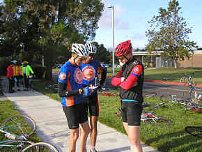
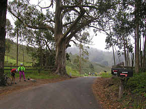
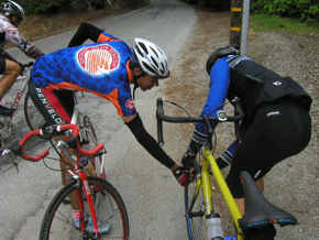
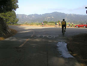
| 7:43am and we're doing the
check-the-course-map ritual before heading out. From left to
right is Dick Kiser, Todd Norwood and Richard Brockie. |
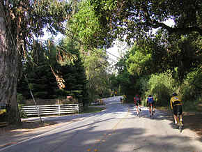
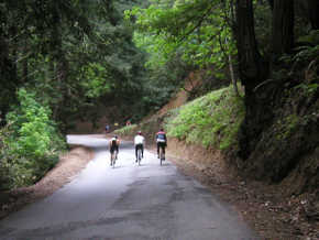
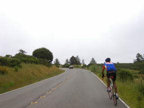
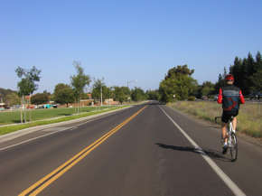
8:03am Fairly pleasant when we
started the ride, with just high clouds and moderate temps as we
approach Alpine Road from Arastradero. |
sm.jpg) |
 |
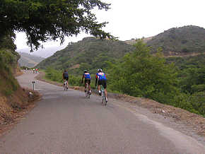
| 8:25am After riding Whiskey
Hill we rode into Woodside and... |
8:41am ...out Canada Road, and
then Skyline (the part North of Highway 92) up towards Pacifica. |
 |
 |
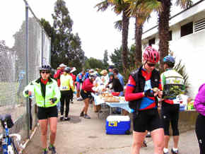
| 9:24am Our first rest stop,
about 28 miles into the ride. And yes, they had Cantaloupe (my
favorite!). |
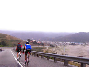
10:12am In Pacifica, heading
down the coast to our date with... |
 |
 |
| 10:22am ...Devil's Slide!
Sorry I couldn't get a decent photo, but it was pretty busy and,
since it's a descent, it was hard to get a photo while riding at
speed. |
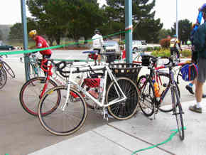
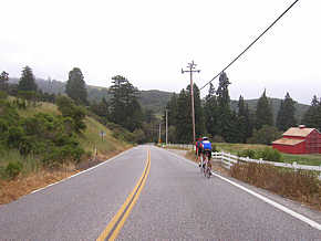
10:57am Rest stop at Half Moon
Bay high school. Seen here is Todd's LeMond, Richard's Klein
and my TREK. (Shameless plug for bike we sell) |
 |
 |
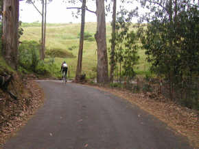
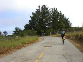
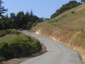
| 11:28am Heading up Purissima
Creek (a little side-trip that I missed the markings for last
year!). That little goof saved me a fair amount of climbing in
2001. |
11:35am Higgins Purissima is
well worth seeking out, for it's light traffic and "how could
something look this remote so close to civilization" beauty. |
 |
 |
| 11:46am Cresting the main
climb on Higgins. |
12:10pm on Los Lobitos Cut-off |
 |
 |
| 12:21& 12:24 pm
Heading towards Tunitas Creek on Los Lobitos. There's actually
quite a bit of climbing on Higgins Purissima and Los Lobitos, so
don't look at the map and think they're no big deal! |
sm.jpg) |
 |
| 12:31pm Just up Tunitas Creek
a bit from where Los Lobitos intersects it. The steep part of
the climb is just ahead! Tunitas Creek is a beautiful climb,
all of it shaded from the sun (of which there wasn't any today!) and
with a babbling brook to the side. |
1:06pm Towards the top of
Tunitas Creek, making the fateful turn onto Starr Hill, which
connects to Swett Road where you'll find a dreadfully-painful (and
fortunately short) piece of steeply-pitched road, just before the
next rest stop. |
 |
 |
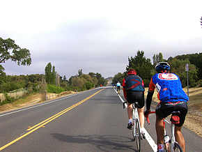
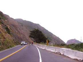
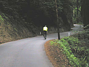
| 2:00pm Heading down 84 to the
coast, passing the famous "Red Barn." This is a fun stretch
until just past LaHonda, where the road surface deteriorates (lots
of gravel) and you get a nasty headwind. |
2:55pm Entering the town of
Pescadero, just after climbing the two fun (they really are fun!)
hills found on Stage Road between here and San Gregorio. |
 |
 |
| 3:15pm Shouldn't we be at
lunch by now??? At least I've come across Jamie Wallach, one
of our customers, to ride with for awhile. |
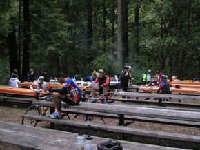
3:42pm Lunch, finally!
This is way later than I expected to be at this point, and
it's a bit discouraging that the course closes at 6pm! Are we
that slow? |
 |
sm.jpg) |
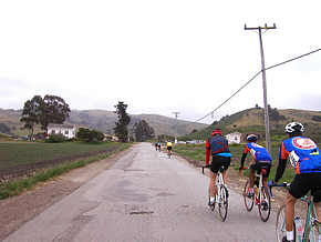
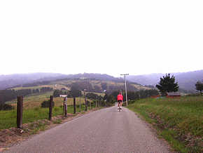
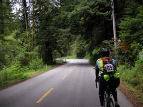
| 4:07pm Todd & I are actually
making decent time up Haskins Grade. Seems like we alternated
between me feeling good and Richard, but Todd always did well. |
4:14pm A rider heading down
Pescadero Road (off Haskins Grade), about to make the turn onto West
Alpine for the final hill assault. Just 3000 ft to go! |
 |
 |
| 4:14pm But first Todd loans a
CO2 inflator to a guy with a flat. |
4:20pm West Alpine starts out
so innocuously! But after a mile or so this road goes UP.
Way UP. |
 |
 |
| 4:38pm Heading up West Alpine,
on one of the less-steep sections. The steeper parts are
simply too steep to take photos on while riding. |
4:42pm The top of the first
section of West Alpine, where we finally see blue sky (and a brief
section of flat road). |
 |
 |
| 5:03pm Almost to the top of
West Alpine, maybe another 200 ft of climbing to go to Skyline! |
5:41pm Arriving back at the
start, considerably later than planned. |
 |
5:44pm You know how Ice Cream
is one of those things you might as well glue to your body, because
you'll instantly put on that much weight? Furthest thing from
your mind right now as the Western Wheelers (the sponsoring club) is
handing out Its Its Ice Cream Sandwiches to all of the riders!
125.8 miles, 15.6mph average speed, 42.2mph max, and
8 hours, 1 minute riding time. A long day on the bike! |
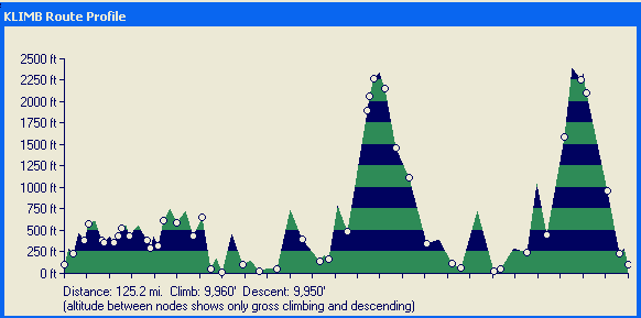
Above is a profile map generated by
Klimb, a downloadable program you can generate such information
from for rides just about anywhere in the SF Bay Area. In this
case, it's slightly underestimating the climbing, since it covers
just the major roads, and doesn't include some of the smaller climbs
into rest stops etc. Overall it was probably around 10,500
feet or so of climbing. |