Tioga Pass 10/10/99 Starting
elevation 6100ft at Crane Flat, just outside of Yosemite Valley (but well
inside the park's $20 entrance fee!) and finishing 47 miles later atop
Tioga Pass, this was one of our more challenging rides, despite the fact
that none of the grades are steep enough to require very low gears, and
the weather was a perfect 64-78 degrees! Five of us started out on
the ride; Bruno, Leslie, Sal, Scott and myself. All but one of us
made it to the end (sorta...Scott decided at the top of the final hill
that all the challenges were behind him, so he sagged a ride to the
bottom).
 |
 |
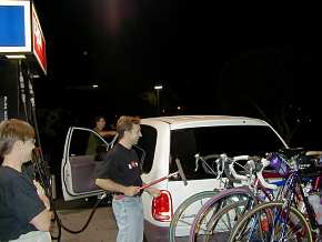
| Leaving late Saturday night, Bruno & Scott do
their "Full Service" attendant imitation, with Leslie
supervising. |
No problem parking at the gas station at Crane
Flat. The store is open from 9am-6pm, and it's the only
store you'll see the entire trip! |
 |
 |
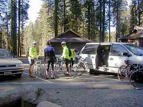
| Not knowing what to expect, we started out with
leg warmers & light jackets, only to discard them shortly
afterward. Mid-October weather is wonderful! |
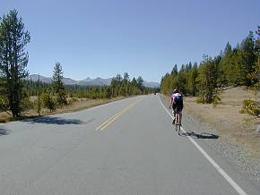
The first milestone...7000 feet! This
occurs after only a few miles, and gives you a
false sense that you're getting somewhere. |
 |
 |
| 8000 feet! And after less than 10
miles. We must be living right, this is going to be easy! |
Not in this lifetime though. This is the
first of many significant descents on the way to the top. |
 |
 |
| Almost three miles down as you drop into Yosemite
Creek, losing all that altitude... |
And what goes down, must yet again come back
up! And up. And UP! |
 |
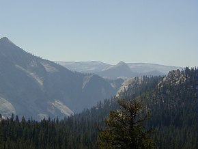 |
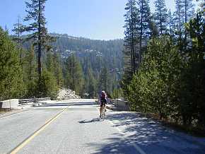
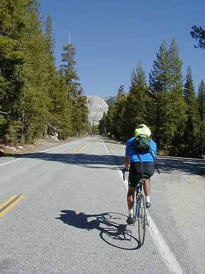
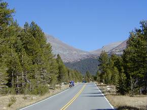
| This is not the type of scenery you'll find on
the other passes on this website, as the predominate theme is
granite. Even the roads are paved with granite. |
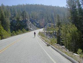
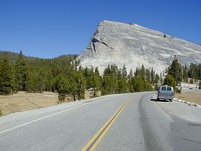
One gets the idea that it's not all that
difficult taking postcard-quality photos...just go to
Yosemite! Pretty amazing stuff, seeing Yosemite Valley from
the back. |
And once again we drop, quickly, this time into Tenaya
Lake. Remember, all these drops will be climbs on the way
back. During this ride, you start at 6150 feet and
finish at 9945. Sounds like almost 4,000 feet of climbing,
right? Not quite. You have to add to that an
additional 2,500 feet that you'll "descend" on the way
to the top.
Of course, that also means that you'll
"climb" 2500 feet on the way down!
|
|
 |
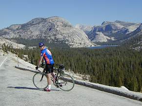 |
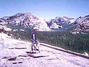
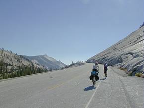
| Tenaya Lake then...and now. The
first photo is from a ride I did many, many years ago! Tenaya Lake is even more beautiful than Lake
Tahoe, with a shade of blue that neither Crayola nor Kodak can
adequately capture. |

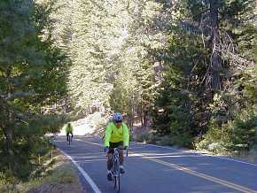
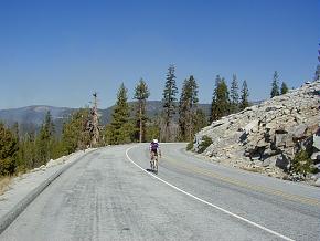
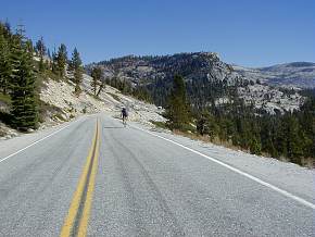
Above we're cruising along the scenic shore of Tenaya Lake, and to
the right we're starting up the climb (yes, that's UP again!) to
Tuolumne Meadows. Big granite rocks are everywhere, adorned
with climbers whose goals are measured in hundreds of feet, rather
than the many miles that ours are. |
 |
| |
|
 |
 |
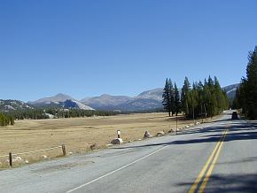
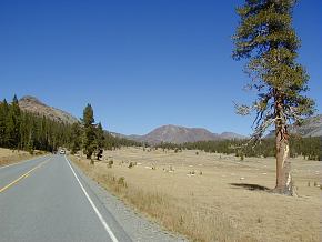
| Rolling into Tuolumne Meadows, one is amazed at
how beautiful this area is, despite the many thousands of tourists
who drive, hike & cycle here every week. |
Leaving Tuolumne Meadows...but why? You
could spend a lot of time in this idyllic valley, but this is not
our destination. It lies...UP! |
 |
 |
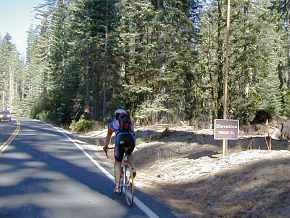
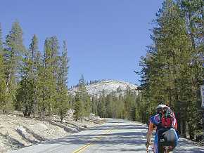
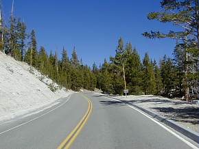
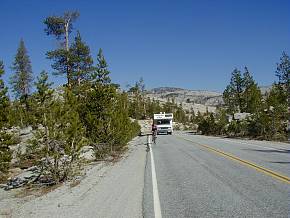
| And UP we go. Finally the 9000ft elevation
sign, coming perhaps 20 miles after the 8000ft sign. 20
miles and untold thousands of feet of climbing! |
The final ascent to 9945 feet is quite
pleasant, although the thin air prevents it from
being merciful. Greeting us are some cyclists from Truckee,
heading to Yosemite. |
 |
 |
| As we near the very top, it begins to look a bit
foreign, similar to the top of Monitor Pass. |
9,945 feet...the proof is on the sign on the exit
station! Now we take a little peek over the hill- |
 |
 |
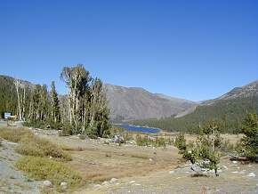
| And see what lies on the other side, which must
wait for another ride. Almost Shangri-La in appearance, it
does call to you! |
But so does the return home, as we head into a
fairly stiff headwind that's suddenly sprung up.
Fortunately, high-altitude winds don't seem to pack much punch. |
 |
 |
| Leslie in front, leading a fully-loaded cyclist
heading from Truckee to Yosemite. Note the road is going UP,
when one believes the direction is supposed to be DOWN! |
And yet another climb on the way down. In
actuality, it is nearly as tough a ride back as it is heading out
to Tioga Pass. Keep this in mind when planning this
ride...it's much longer than it looks! |
 |
And finally, 94 miles later, back at the
car. Didn't have to wait too long for Leslie to get here,
and Sal arrived maybe half an hour later. Scott was still
out there and, since it was getting late, we headed back up the
road and picked him up just a couple miles out. Bruno just
did a one-way trip up the hill, with his family picking him up
near the top. |
Things to consider before doing this ride-
The only safe drinking water is at the start of the ride and at
Tuolumne Meadows, almost 40 miles later. This means at
least two full large-size water bottles, refilled at Tuolumne
Meadows. Better yet, three bottles if you can carry them, or
maybe a CamelBak. Looking back on the ride, a great idea
would have been one of those bottles with a built-in filter, so
you could reload at the various creeks you come across and not
risk giardia infection.
Also, unlike most rides on this site, there is no shade while
riding. Sunscreen is not an option, it's a
requirement! This is also one of the reasons you're going to
go through a lot of water; the other is that high-altitudes mean
you breathe more rapidly, and you lose water every time you
exhale.
There are no stores anyplace along the entire route where
you can buy something to eat. There used to be facilities at
Tuolumne Meadows, but near as we could tell, the only available
luxuries there were drinking water and restrooms
(This is no longer true; there is a store now at Tuolumne
Meadows, but it's open only a very small part of the year, from
July-September according to someone who recently emailed me.
--Mike-- 12/07/05). The
obvious lesson here is not to get caught short on food! Keep
in mind that you're going to be out there all day long, so you'd
darn well better carry at least as much food as you'd eat in a
normal day, and force yourself to eat, even if you don't feel like
it.
This is a very long ride, feeling more like a 200k than a slightly-sub 100
miler. Start out as early as possible; we began at
9:30am and it really would have been better to have been out on
the road earlier than that. Depending upon the season, much
earlier might not work out, since it can be very cold in the
mornings. We finished between 5 and 5:45pm, which was really
pushing things, as the towering granite landscape can cast some
pretty dark shadows as evening approaches. I also noticed
that there's a mini rush-hour around 4:30 where all of a sudden a
lot of people are heading back home, and many seem pretty
impatient.
And a note about gearing and conditioning. You don't
need to be very strong to do this ride, as none of the hills are
very steep (I never used anything larger than a 21 tooth
cog). You do need a lot of endurance though! The
relentless nature of the climb-descend-climb-descend-climb cycle
takes a lot out of you, so endurance is the most important
attribute to carry with you on this ride.
--Mike-- |
Last updated
12/07/05
|