Not every ride has to involve monster climbs!
Check out this 25 mile loop from Woodside to Los Altos-
 |
And while you're at it, you can check
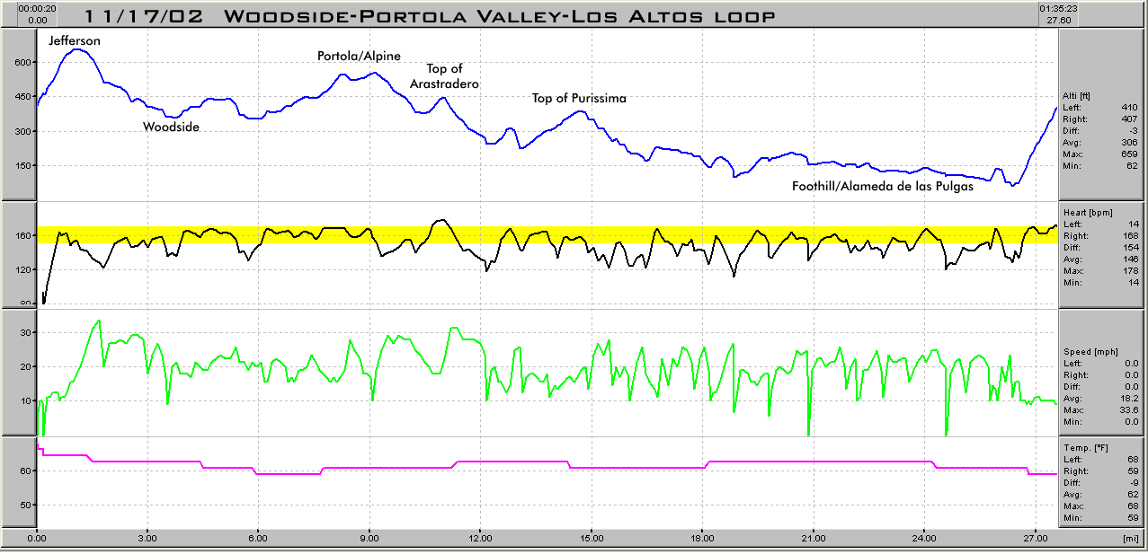
out the printouts from the HAC-4 computer installed on my bike.
Above you can see recorded altitude, heart rate, speed and
temperature. Not shown is power (in watts). The HAC-4
frees you to have fun on your bike and then analyze it later, and
has proven to be remarkably accurate for altitude, something rare
among bike computers.
I would normally try to get in some long, relatively steep climbs,
in order to get the best-possible workout in the little time I have
to ride (which is why my Tuesday/Thursday morning rides go up King's
Mtn to Skyline). But today (11/17/02) I decided to try and
force my pace on a flatter ride, and see if I could keep my heart
rate up. The result was better than I thought, as I was
generally able to keep my heart rate at or slightly above 160, with
the exception of the downhills. |
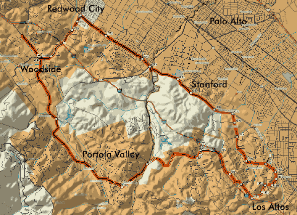 |
I actually began the ride a bit up
the east side of Jefferson in Redwood City, but we'll assume the
traditional starting point for rides on this website, which would be
Olive Hill at Canada Road, about a mile north of the town of
Woodside.
From there we head south on Canada to Woodside, through Woodside on
Mountain Home Road, onto Portola Road and Alpine through Portola
Valley, and then a right hand turn off Alpine onto Arastradero.
When Arastradero hits Page Mill you head left, and then take the
first right up the road that parallels the freeway for a bit and
then drops down underneath it. Make the first right hand turn
after the underpass onto Purissima, which dead-ends at Robleda,
where you head left. Go about .7 miles and turn right onto
Chapin, which dead ends into Burke, where you make a left.
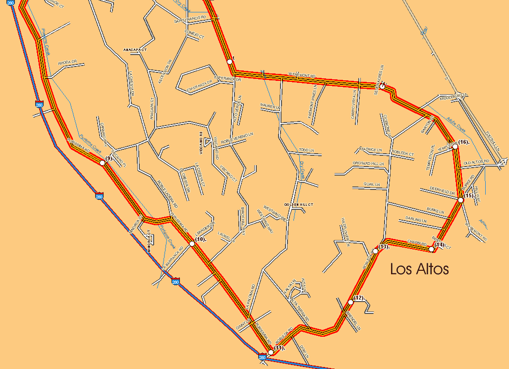
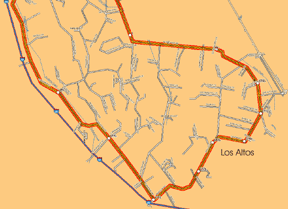
This is getting confusing- below is a detail map showing the
southern (Los Altos) portion of the ride- |
 |
| More to come- I'll steal some photos
of the roads on this ride from other places on our site.
--Mike-- |
Last updated
05/06/05
|
[menunew.htm]
|