One of the most truly amazing things about this ride is how quickly you can exit
civilization and get out to the "Great Valley." Total distance is under 30
miles, road surfaces run from good to not bad, and car traffic is exceptionally light (we
saw no more than 20 cars other than on Greenville Road).
My brother Tom and I did this ride on Sunday, July 5th, 1998. It starts out
deceptively easy, with the gradual climb up Altamont (with a tail wind, no less!) making
you feel much stronger than you really are. Watch the temps...it can be 15 degrees
hotter on the Sacramento Valley side than Livermore. Also note that there's
no food or water to be had anyplace on this loop...you're on your own.
Carry at least two full waterbottles and possibly some powerbars as well!
There's only one major climb, and it's a biggie...Patterson Pass. We can tell you
all about it, and it still won't measure up to just how nasty it is in real life.
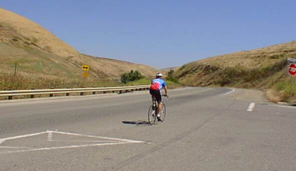
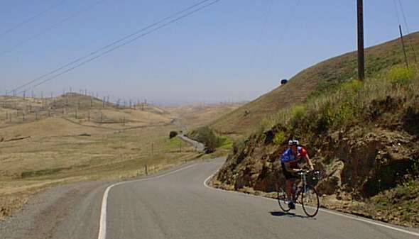
This is at #1 on the map above, and shows Tom continuing on Altamont Pass Road. On
the right is a nasty little climb that parallels the freeway and ends at North Flynn Road.
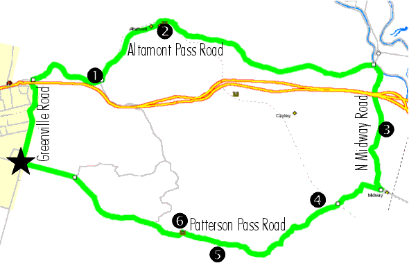
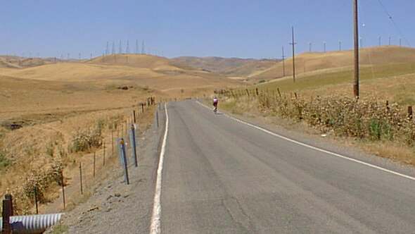
This is near #3 on the map, the top of Midway Road. Not too bad a climb, but it's
beginning to get just a bit warm by this point. We're now on the Sacramento Valley side of
things (visible in the background). [Note that we skipped a photo for #2,
which is simply the "summit" of Altamont Pass. Not much there, just kinda
slowly rolls upward and then back down.]
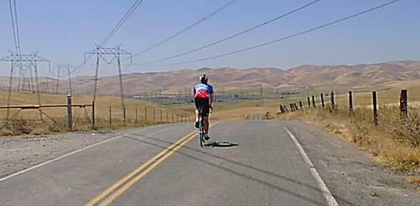
We descend into "Midway" which is really nothing more than a very large PG&E
substation (and in this photo looks like a poor "matte painting" like they used
to use in old Star Trek episodes). Better make this descent last...you're not going
to see another one for quite awhile!
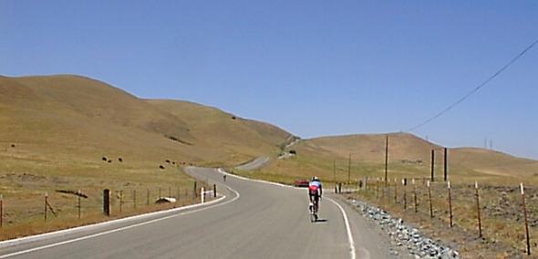
The party's over! This is looking forward from #4, just past the railroad
bridge. We're getting hot now, up over 90 degrees, and it's obvious we're in for a
sustained climb. It's shortly after this that you start fantasizing in your mind
that you must have either just passed, or are coming up to, that infamous false summit
that everyone talks about. You'll mull this over in your mind (or what's left of it
after the heat takes its toll) many, many times.
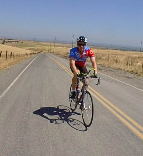
Riding
up towards the final false summit (#5 on the map). What lies just over the hill has
been enough to elicit screams from the strongest of knees. But silly you...still
clinging to the idea that the false summit is behind you and this is the top.
Just how bad could the false summit possibly be?
Well, if you look at this photo from the archives, you can easily see why
you want to believe it's the real thing, and not just a small rise.
It's mean, it's nasty, and it ain't nothing compared to what's coming up!
Here we find the real McCoy. After the last false summit, you pick your eyes up from
the road and stare in disbelief at the real thing. Hard to see here, but this final
part finds many having to walk their bikes and is much tougher than it looks.
But, as you can see, Tom makes it over the top (#6 on the map), even if he does have to
use both sides of the road to do it! From here on in, it's all
downhill...really. I should also point out that, if you're doing
this loop in the opposite direction, you're looking at one of the all-time
great descents. We're talking tremendous visibility ahead (a good
thing on a barely 1.5 lane road), good surfaces, fairly wide (and
sometimes even banked!) turns and enough of a grade that speeds of greater
than 40 miles per hour are easily attained.
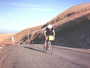
For a sense of history, here's a photo taken many years earlier (probably
1981?) of a mushroom-headed cyclist (me, wearing the first-generation Bell
helmet) cresting the top. Even though this is within just a few feet
of where the photo above was taken, you get a much better idea of just how
steep this road is, as it just drops out of sight in the background.
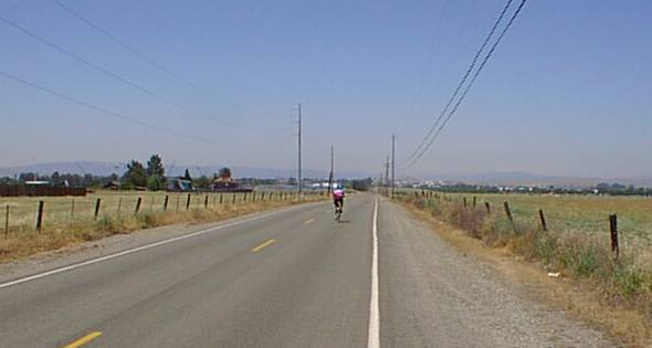
This is one of the more amazing photos...because we're only a couple miles outside of
crazy, crowded Livermore, yet this photo might have been taken in any number of extremely
rural settings. That's one of the most wonderful things about riding in the SF Bay
Area...it doesn't take very long to get away from the crowded cities.
Overall, this ride serves as a great introduction to "real"
climbing, without getting too far away from civilization or having to
endure such long nasty climbs as to make it appear hopeless unless you're
in really good shape. It will, however, get you far from any food,
water or other services and, if you ride it in the summer, it's going to
get very, very hot!
More information about riding some of these roads can be found in the
story about the Corral Hollow Road Race, which
involves attacking Patterson Pass from the west side (and enjoying the
incredible descent on the east side).
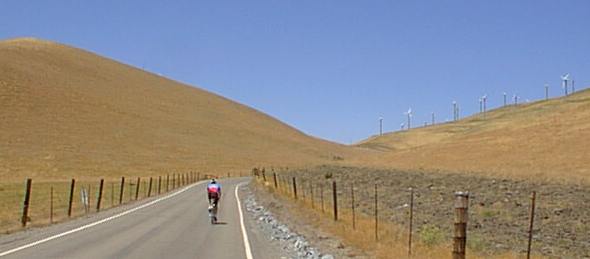
Here's an email received on 5/19/02 about a regular ride on this
loop- Just looked at your website and noticed a writeup for the Patterson
Pass Loop. Just to let you know, the Lawrence Livermore Cycletrons ride
this loop every Monday and Thursday (2 different group rides - A and B
teams, as we call them). See
http://www.llnl.gov/LLESA-groups/cycletrons/. You should try riding up
Patterson when the wind is really blowing and the windmills are howling.
We've had some people actually get blown off their bikes! There's a corner
called Trackstand turn. It's called that because, when the wind is really
blowing, it can almost stop you as you come around the hill which shelters
the corner, and you get hit by the full force of the wind. We've got
another hill called Religion. It's a steep, false summit. Once you hit the
top of this grind, you see the rest of the climb that awaits and you have
a religious experience. There's also Frank's Tree, which is now dead but
was the only shady spot on the ride. On a hot day, this fellow named
Frank, who has since left the Lab, would seek shelter under it so it got
its name. Mike D.
Chain Reaction sells bicycles & accessories
from Trek, Gary Fisher, BikeFriday,Shimano, Pearl Izumi, Continental, Descente,
Sidi, Giro, Blackburn, Speedplay, Oakley, Saris, NiteRider, Bontrager,
Torelli, Look, DeFeet, Rock N Roll, Hammer, Cytomax,
Powerbar, Fox, Clif
Bar, CamelBak, Chris King, Profile Design, Craft, X-Lab and many more!
 Select & join email lists