There will be some choices this year, with
a "fast" group (capable of reaching the top in around 1:30-1:45 or so)
leaving at 9am, and a more moderately-paced "social" group
(approximately 2:00-2:45 pace to the top) leaving at 8:30am.
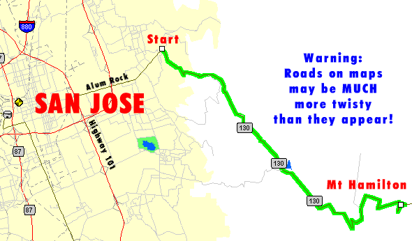
We leave from Alum Rock & Mt. Hamilton Road. Easy to get to, as there's an
Alum Rock exit from 101. Just head east, past the part where it changes
from 4 lanes to 2, up into the foothills a bit. There's generally
parking right where we start, but if not, there are nearby schools.
This is entirely unsupported. No food, no water, no car to carry
your cold-weather gear to the top (where it can sometimes be
extremely cold). No place to get water anywhere along the route
either, with the exception of Grants Ranch at the lower part of the
climb (but you won't need it at that point anyway). --Mike--
Why no pictures from the '04 Mt Hamilton Ride?
Read below-
01/01/04- I'm not that brave!
Mt. Hamilton 2004 is a wash-out, possibly literally, as I sit here listening to
the wind blow against the windows, and notice my fish pond is about to
overflow from all the rain. If any brave souls do make it up the
hill, I'd love to hear about it!
January 1,
2003 had to be one of the nicest days ever to climb Mt. Hamilton.
Low-to-mid-50s temps, no fog, fantastic views. What's not to like?
With the nasty weather we'd been having up until just a couple days ago,
we had no idea what might have been in store for us; perhaps an epic ride
through freshly-carved banks of snow!
Do we need more balance on our website? More rides featuring something
other than climbing? For a brief moment I considered this...and then
realized that, without exception, every single ride on this website has as
much downhill as uphill! This ride is no exception.
Mt Hamilton is a traditional New Year's Day ride for quite a few, with
more than 100 riders challenging the hill some years. And what a
hill it is! At 4200ft+, it is the tallest peak in the Bay Area, eclipsing
Mt. Diablo, Mt. Tamalpais and Loma Prieta. And, at 18 miles, it's also the
longest (although the climb is punctuated by two descents of approximately
a mile each).
Very few riders would need a triple crankset on this ride for its grade,
since it never gets very steep. On the other hand, due to its length it
can wear you down, so lower gears might give you a chance to rest. But
there's nothing as steep as the nastier sections of Page Mill, or even Old
La Honda for that matter. It's just plain long!
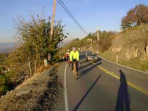
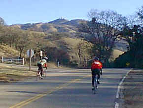
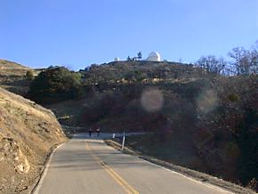
The start of the ride, and the base of the mountain. No warm-up...just
straight up the hill! It's not so bad, since the grade isn't very steep.
For the first several miles you hug the side of the hill, with views of
Silicon Valley that get more impressive with every foot you climb.
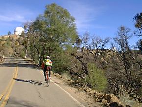
It's truly amazing how quickly things change from city to country. This
is still on the first part of the climb.
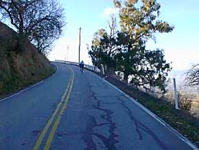
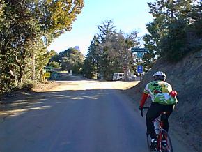
Approaching the end of the first climb, the grade levels off and then
you drop into the valley that holds Grant Ranch Park, a favorite of
mountain bikers. In the winter, ice is quite common once you get over this
first hill, so be careful!
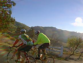
Enjoying the climb out of Grant Ranch! On the left is Dick Kiser
(former Redwood City staffer), and next to
him is Louis A, one of our customers, on his new TREK OCLV
road bike. [Sorry, had to get that plug in!] Behind is Jeff K, who reps for one of our suppliers.
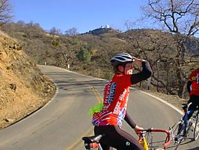
Your first real view of the observatories that mark the top of the climb
comes at the top of the climb out of Grant Ranch. From here you descend a
mile or so to the creek crossing in the photo below.
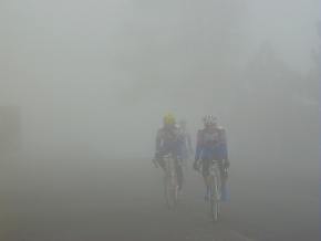
From our special Y2K edition, January 1st,
2000, you see that the weather isn't quite as nice as it was in
1999. In fact, that overcast at the top of the mountain is going to
grow much, much worse!
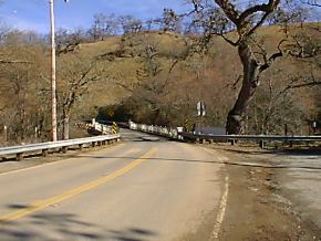
By the time you reach this very old (and very narrow!) bridge, you're
within six miles of the top. Fortunately, traffic is so light on this
route that things like narrow bridges and blind corners aren't much of a
problem. Still, make sure you keep to your side of the road, and assume
there will be gravel!
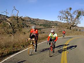
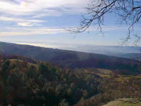
By all means stop once in awhile and check out the views!
There's more to life than focusing on that darned observatory on top of
the hill (the one that never seems to get any closer...). On a clear day
you'll see the Sierras, the mountains around Monterey, San Francisco Bay,
Morgan Hill...a truly impressive 360-degree panorama!
We're getting closer. Just ahead on the left is a short-cut that goes
through some of the observatory housing; one year the race was detoured
this way due to road work. 10%+ grade after 17 miles of killing yourself
was not fun!
It looks so close...and it is! You're in the last mile or so here.
This is the top of the main road; if you go straight, you'll eventually
get to Livermore (50 miles). And no, it's not all downhill! But we're
turning right for the final 1/4 mile climb to the observatory.
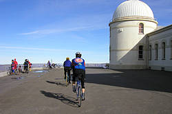
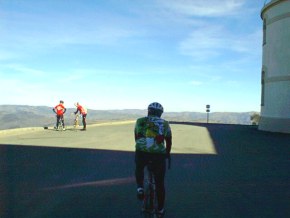
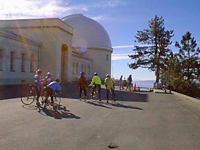
You've made it! Most people started up the hill considerably later
than we did, since we're the only people at the top at the moment. Shortly
many more would follow...but we can say that nobody passed us on the way
up!
Looking down from the top, you see a rider on the road below, making his
way up the final part of the ascent. You also get a great view of the
valleys and mountains you crossed to get here!
As we prepare to leave, quite a few more cyclists have arrived at the
top. On the way down we saw many, many more...and I don't recall a single
one that didn't give a friendly wave of say hello, even those charging up
at warp speed.
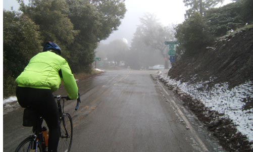
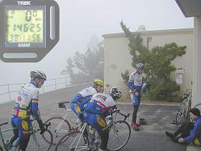
And things are just a little bit
different for January 1st, 2000! 38 degrees (actually was as low as
35) and very, very low visibility. Believe it or not, the photo on
the right was taken from the same place as the photo above it (with the
observatory dome in the background).
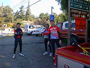
One
happy-looking group at the end (and this was for the 1999 ride, held on a
spectacular day. For the Y2K ride, we were even happier)! Actually, the descent is not terribly
enjoyable, with its many potholes, gravel & sand in the corners and
even patches of ice. So yes, you are glad to be back. And for us, we can
now go the rest of the year knowing that at least we accomplished
something! --Mike--
Chain Reaction sells bicycles & accessories
from Trek, Gary Fisher, BikeFriday,Shimano, Pearl Izumi, Continental, Descente,
Sidi, Giro, Blackburn, Speedplay, Oakley, Saris, NiteRider, Bontrager,
Torelli, Look, DeFeet, Rock N Roll, Hammer, Cytomax,
Powerbar, Fox, Clif
Bar, CamelBak, Chris King, Profile Design, Craft, X-Lab and many more!


 Select & join email lists