We'd push the limits this time,
skipping the usual last Sunday in June in favor of a late-season
Fall just-before-the-snow-hits ride. Just two of us this time,
myself and Jeff K (whom I've ridden a number of centuries with, and
is an earlier victim of Sonora Pass as well). Gorgeous day, temps
starting in the low-50s and drifting casually up towards 80 at the
far side. This is, as I've said before, a "greatest hits" ride. It's
not very long at just 52 miles, but it hits up both sides of Sonora
Pass, starting in Dardanelle, heading out to the Marine Camp near
395 and back.
This is also a ride whose spec's don't tell the story. It's only
7,000ft of climbing, which really shouldn't kill you. And the
legendary grades? Yes, they're legendary in difficulty, but if
there's to be truth in advertising, those signs warning you of
24-26% grades? That describes the worst-possible line through the
worst corner. The reality is that the hardest sections average
"only" 15%, most of them "just" 10%. So what makes it so difficult?
Probably the fact that it starts out so darned hard! Just 5 miles
out of Dardanelle and you hit the infamous section "window" section,
over half a mile averaging 15%.
Directions to the start- From the SF Bay Area, head out 580 and
follow the signs to Sonora (which is on Highway 108). Pretty easy;
Dardanelle is about 52 miles up the road from Sonora. No way to get
lost; the road only goes one place.
We've done this ride every year since
1998, but it's never been routine.
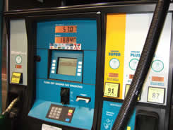
As with most trips these days, this one
started out with an over-priced tank of gas, over $50 worth.
Originally we'd planned to stay at Dardanelle Resort, but they
weren't answering their phones (and when we got there we discovered
why- they were completely locked up for the season!). So instead we
stayed at the Alladin Motor Inn in Sonora. Nicer than most places in
Sonora, and just over an hour from Dardanelle.
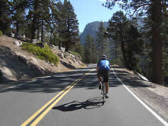
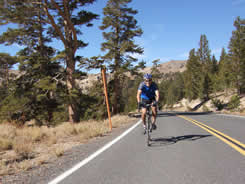
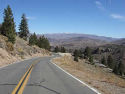
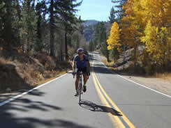
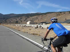
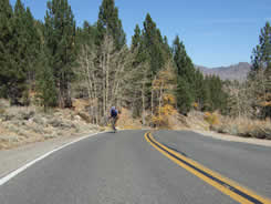
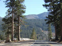
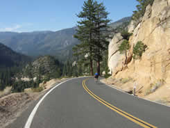
As always,
the ride starts out quite peacefully, with no hint of what's to
come. Nicely-paved road, not too much traffic (although truthfully,
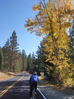
a bit more than we expected for this late in the season).
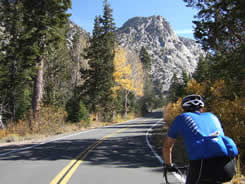
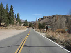
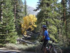
Don't let anyone tell you we don't have seasons, for "fall colors",
in California!
After a while I have to admit that it does get tiring hearing people
talk about how California doesn't have seasons, how we don't have
the oranges & reds you see elsewhere. We do; you just have to get
out to find them, and when you do that on a bike, it's especially
beautiful.
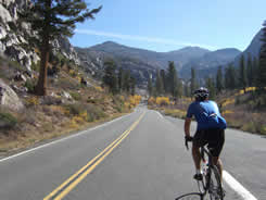
The Stanislaus River is a nice companion on the lower (almost flat)
part of the ride. It will later make an appearance now & then around
Chipmunk Flat and wrap around the Golden Stairs (not true it
turns out; that's Deadman's Creek), but at that
point your eyes are having a difficult time making things out
through the constant bath of seat coming off your forehead. Enjoy it
now, while you can.
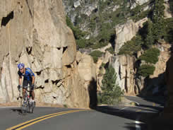
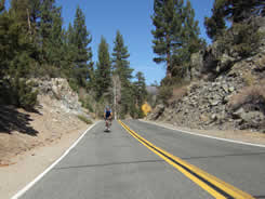
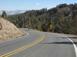
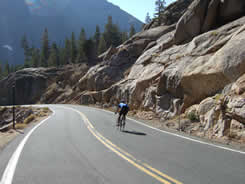
The
infamous sign. 26% grade up ahead. It says 1 mile, but to be
truthful, I've never measured it.
And here she is- the infamous "Window"
where the grade theoretically hits 26%. The reality is probably
closer to 20%; maybe if you got the inside of a corner you'd get 26?
But it's steep, and really rude, especially so early in the ride. On
the
topo map, this is just above the 6713' benchmark. 615ft of
climbing, 15% average grade, heart rate 108 at the bottom and
170 at the top.
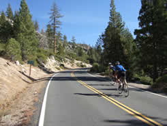
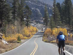
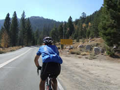
After a
bit we caught up to Eric, a guy from Santa Cruz who'd been in the
area for a few days. For the next mile, the grade averages 10.4%.
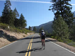
The grade mercifully eases off to maybe
7% even a bit less for short distances, allowing you to see speeds
as high as 10mph! This too shall pass, as you hit the next really
steep section (shown in the next photo).
Why does
it hurt so much? Probably because, before this "flat" 5% grade,
there's a nasty 12%+ grade.
One of the
several false-flats, although truth is, this one really is! Just
doesn't feel like it's really flat.
Not shown
is the noisy creek on the right, probably the headwaters of the
Stanislaus, and a pleasant companion.
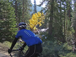
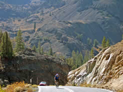
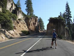
Ahh... Chipmunk "Flat." Which is
anything but flat. But it's where you first notice the wall of
granite you're heading directly into, with no way out. This is the
entrance to the infamous "Golden Stairs." Hard to believe
non-motorized vehicles can make it up the Golden Stairs, whether
they were wagons from days gone by, or bicycles. What was the
weather like?
Check here for the weather station at 9250ft.
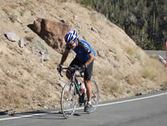
This if
Jeff on the Golden Stairs, probably wishing he was on a motorized
vehicle about now. It looks steep, but it's even steeper than it
looks. 20% in fact. Check out the
topo &
aerial views!
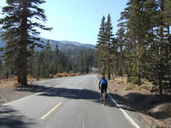
Just past 9000 feet the Golden
Stairs levels out to a pleasant 8% for a mile or so, and then
what would normally be an easy 5% on the final run to the top. But
after what's come before, it does not feel easy, and the top
is a very welcome sight!
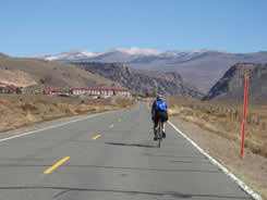
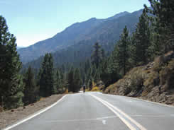
The run
down the backside is... fast. Very fast. Beautiful views of the
White Mountains in the distance.
Descending
this, you're wondering just how bad it's going to feel on the
return. You needn't wonder. It's going to be as tough as it looks.
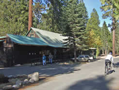
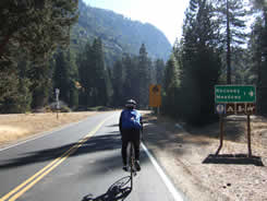
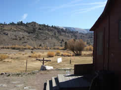
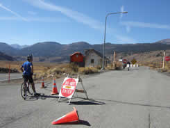
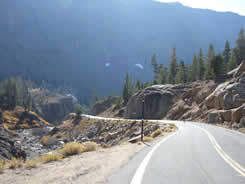
Around 7200ft, the road levels out for
a bit and you come across the
Leavitt
Meadows Pack Station on the right-hand side of the road. Just
past, on the left (in the photo above-right), is a place the marines
use for wall-scaling exercises, which normally has a large water
tank where you can fill up on your return up the east side. This was
the first time it was not there, giving us some concern about
having enough water... not a good thing!
Here's the goofy thing. At the Leavitt
Meadow Pack Station, someone had set out a pair of bottle waters on
the front porch. Nobody was home; we were going to offer to pay for
them, but didn't want to deprive someone else more desperate.
Fortunately, there was still water flowing at a campsite faucet just
down the road; this is not normally the case. Do not
depend upon water being available... we got lucky.
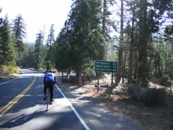
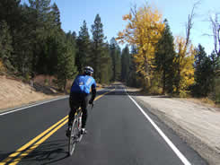
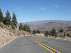
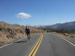
It really
is this pretty in the Sierras. Don't forget to bring sunscreen, as
this ride is entirely out in the open. We did forget, and
planned to buy some at the Dardanelle store... which was closed.
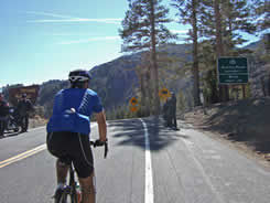
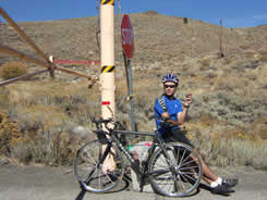
Approaching the Marine Camp (actually
their winter warfare training facility), which for all intents &
purposes was deserted. Even the guardhouse where a few years ago we
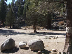
found a couple of kids with M16s.
Lunch
time! Basically a couple of powerbars and a nice concrete block to
sit on.
Time to turn around & head back, after
briefly contemplating riding another 3-4 miles out to Highway 395.
The Marine camp is almost surrealistic, like some secret place you'd
hear about in the X-Files.
That
little climb back to Leavitt Meadows can't be all that much, but
it's your first indication that it's a tough ride back.
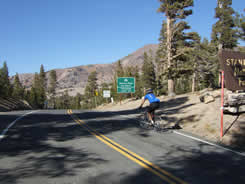
Pretty
strange when, in the middle of nowhere, someone drives by that you
know. In this case, Bob & Tracy of Cycle Caifornia magazine.
29.88 miles into the ride, 7201ft.
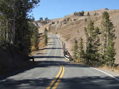
Leaving Leavitt Meadows, you're back to
the real grind. The sign tells you of steep grades ahead and warns
big trucks and trailers to stay away, but says nothing about bikes.
It doesn't have to, because you round that corner and kaboom, the
first really ugly grade. It flattens out in a bit, and then... (Click
here for a satellite photo, which can also be changed to a
topo map, to get a feel for what the road does here)
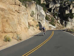
...and then the first really
ugly grade. You have the briefest opportunity to breathe between
each one. Very brief. This is arguably the worst, and the
most-beautiful. A very steep pitch with a switchback and great
views. The next 1.24 miles average over 11%, but feels a lot
steeper.
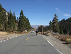
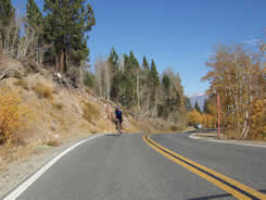
Sonora
Pass toys with you once again, leveling out to maybe 5% with little
bumps considerably worse.
Leading into and emerging from another
step up the mountain. The front (West) side of Sonora Pass is much
less varied in terrain than the back side, but while you'd think
that would give you a chance to recover, it just doesn't work that
way. Quite the opposite in fact, as your mind says it should be
easier than it feels. (Click
here for topo map)
Up to the
final plateau before the top.
Yes, you're actually seeing a bit of
downhill, and were it not for clearly seeing what's ahead for the
first time, there'd be a sense of peace. However, where the road
disappears in the photo at the right... that's where things get
really silly. You head to the left a bit, the road pitches up
nastily, a hairpin right, another quarter mile of nasty stuff and
then you're at the top of something, looking at a short descent
before the final climb (show in the far-right photo).
Who makes
roads like this anyway, and how? How do they keep the asphalt from
sliding back down the hill? This is the beginning of the final
assualt on the top. The tough part is figuring out if you have time
to go to your larger chainring and then back down. (Aerial
view here)
Jeff powering up the final grade to the
top. It's listed as 15%, and I believe it. At sea level it might not
be so tough, and the curious thing is that you don't really feel
like the altitude is getting to you, but something is.
Probably the cumulative effect of having done both sides on the same
day. Still, it's less than 8,000ft of total climbing, but it
definitely passes the "tough ride" test of over 1,000ft of climbing
per 10 miles! (Topo
view &
Aerial view).
Pausing to
read a bit about the history of Sonora Pass. No mention of bikes.
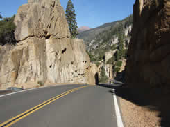
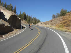
Descending Blue Canyon is an amazing
experience. If it's possible, it looks even steeper going down than
it did coming up. This photo is just about 9000ft.
Another
look at Blue Canyon, which is difficult to shoot with the afternoon
sun.
Jeff stopping just below "The Window",
admiring the view and giving the brakes a chance to cool, and then
later heading down, fast.
What does it take to do this ride?
The obvious- low gears. If you live on
or near the San Francisco Peninsula, I'd suggest trying out
Bohlman/On Orbit out of Los Gatos.
Whatever you need to make it up that grade is what you'll need for
Sonora Pass. Many of us are using "compact" cranks, 50/34 front with
12/27 rear. A triple would be even better.
Water. It can get hot up there, plus you lose a lot more water
because you're breathing faster in the thinner air. Two full bottles
on each side, which means refilling on the opposite side.
Food. No choice but to bring your own!
Look hard
and you can see the scar of the road way way down, on the left. This
is your final descent into Dardanelle.
One last
stop just before the end, admiring the Stanislaus and the fall
colors. 52 miles, 5 hours, just another day on a bike.
Links to other rides up Sonora Pass- Oct 1998 (our first
one!); June 2000 near-disaster;
June 2001,
Oct 2001, and eventually we'll get some info up on the "missing"
rides from 2002, 2003 & 2004! We really did ride each of those
years, just no web page yet.
Chain Reaction sells bicycles & accessories
from Trek, Gary Fisher, BikeFriday,Shimano, Pearl Izumi, Continental, Descente,
Sidi, Giro, Blackburn, Speedplay, Oakley, Saris, NiteRider, Bontrager,
Torelli, Look, DeFeet, Rock N Roll, Hammer, Cytomax,
Powerbar, Fox, Clif
Bar, CamelBak, Chris King, Profile Design, Craft, X-Lab and many more!


 Select & join email lists