Apparently, our prior ride, an out-and-back
from Bear Valley to Markleeville, wasn't enough for us.
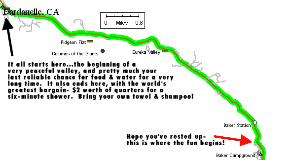
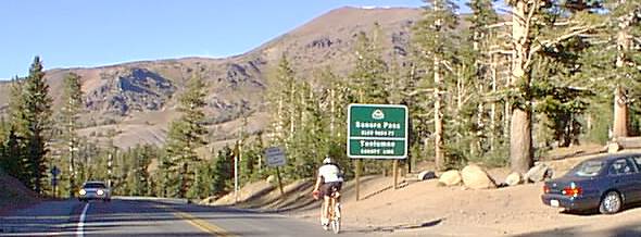
This time we go from broke- a wimpy 51-mile ride from Dardanelle to US 395...and
back. That's twice over Sonora Pass in one day.
[By the way, this page is now recognized by
websites around the world as the "Sonora Pass Website." I
didn't realize that until I checked the logs to see where visitors to this
page were coming from...Europe, Canada, all over the place, and referred
to this page by all manner of other websites. Guess we're famous!] |
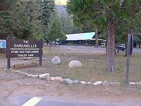
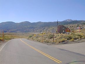
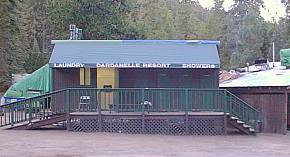
This is a great place to start your ride. The store's apparently open just about any
time you'd consider riding your bike over the pass. |
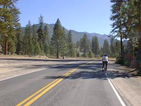
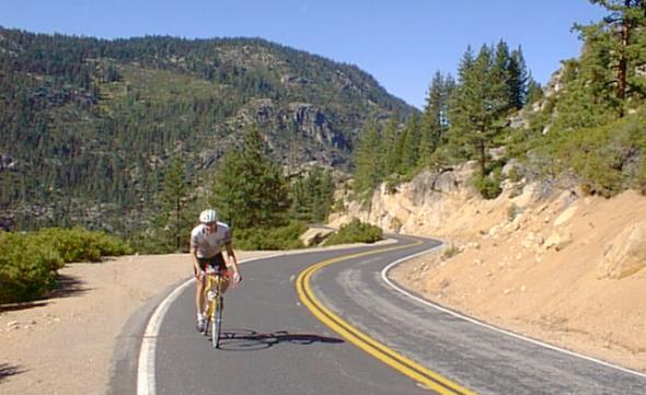
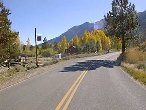
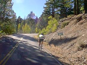
Your ride starts out unbelievably easy and peaceful. Nice wide road, gorgeous vistas, and,
of course, it's flat. |
 |
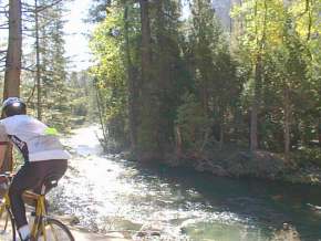
The Stanislaus river is a beautiful (and noisy) companion for a short while. One of the
more interesting observations is just how much water is still flowing, this late
(mid-October) in the season. Either an indication of a lot of snow still up there, or a
whole lot of elevation still to climb! The latter proved correct. |
Do we really need to explain anything here??? |
 |
 |
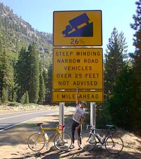
Not much needs to be said here...on the left, we've found our 26% grade, or at least part
of it. Clearly I need to work on camera angles, since it really doesn't look all that
bad...at least not until you see Dick (in the photo above) taking a break, and he's
a very strong rider! This hill, by the way, is one of those times you wish you could find
the weak link in your bicycle...something that will break before your knees do! |
 |
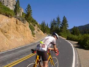
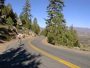
| This is what makes it all worthwhile...right?
Beautiful day, very few cars (and the ones you do come across are struggling mightily to
make it up the hill), very good pavement...if your legs and lungs weren't screaming so
loudly... |
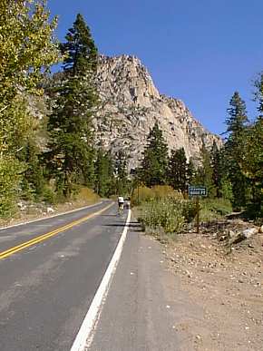 |
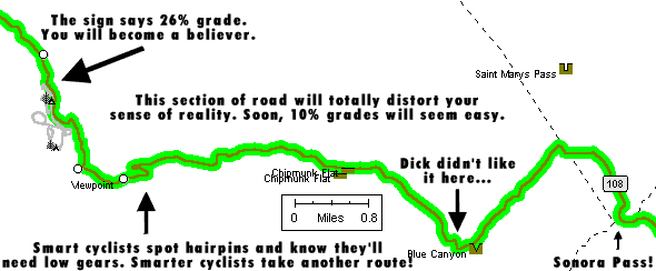
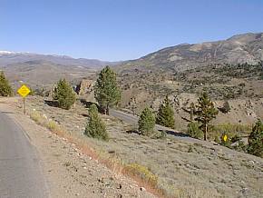
One learns quickly not to trust indications on maps. For example, the area above is known
as "Chipmunk Flat." Well, on this ride,
"Flat" refers to just about anything under 10%. The only thing I could
figure out is maybe it referred to run-over, "flattened" chipmunks? Also
note something else here...we're heading towards the end of a canyon, with no exit in
sight. |
 |
 |
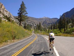
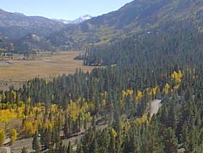
| This is truly some of the most beautiful area I've
seen, although, frankly, it looks much prettier two days later than it did through my
salt-stung eyes at the time. On the map above it's called "Blue
Canyon." |
 |
 |
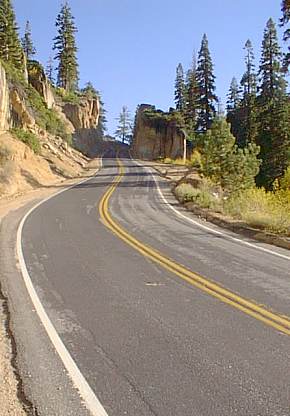
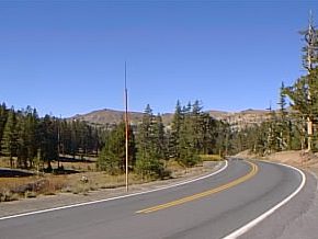
| Just prior to the top it looks very similar to the area around
the summit of Monitor Pass. |
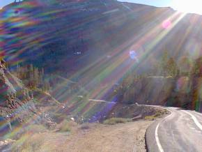
At last!!! Now, the amazing thing is that after this climb
we're going down to the bottom of the other side, and come back up it again!!! |
 |
 |
 |
| The trip down the east side of the pass would be
intensely pleasurable if you weren't thinking about what it was going to be like climbing
back up it! But heck, that sign only reads 15% grade for the next mile, and you've already
handled 26%! |
 |
 |
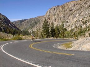
This is one of the things that makes this ride worthwhile. If
you look carefully, you'll see the road on three levels here (you can see the lowest level
just to the right of the yellow sign on the middle level). You might also note that this
ride would be murder on a hot day- we were fortunate and temps ran from 60-76 degrees,
except at the very end where it dropped into the low 50s. |
 |
 |
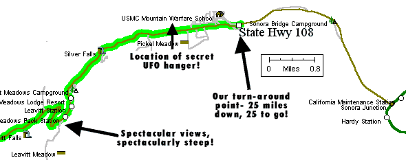
| Here we've turned around and are now heading back towards Sonora
Pass and away from US395. Just over 25 miles and you're home! |
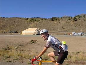
Check it out...Dick's riding past super-secret Area 55, complete
with a hanger holding a UFO. |
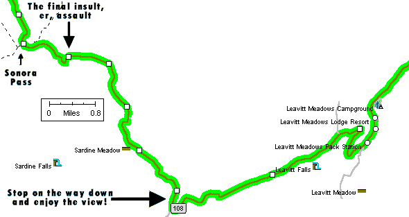
Here's the
Leavitt Meadows Pack Station, which marks the beginning of the nasty stuff on
the return back up the pass. |
This is one of the flatter parts of the ride, which gives you just enough of a breather
than you can appreciate the pain in your legs & lungs. |
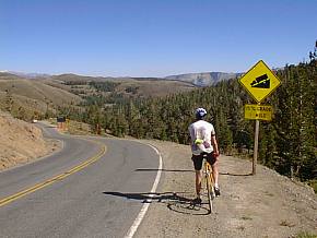
There seems to be a shortage of elevation signs on this ride, so the ones you do come
across (7000ft here) are noteworthy. |
Hmm...last chance to breathe on the ride, and you're once more heading into a wall at the end
of a valley, with no exit in sight. |
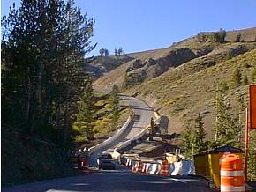
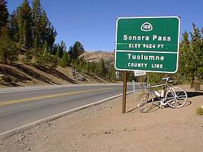
What defines a sierra pass? Perhaps the fact that it's steepest at the very top? This
begins the final mile of climbing to the top, and just for fun tosses in some road
construction. |
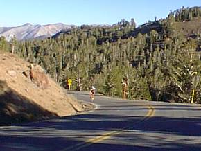
This is the view from the summit (facing east), with Dick just about to make it over the
top. |
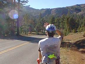
Here we go...second time over the top! Thank goodness. Should have mentioned earlier that
one of the things that keeps you going on a ride like this is listening to how hard the
cars are struggling to make it over. Also, we got lots of encouragement from people in
cars...nearly everyone was very friendly. Must have been "be kind to dumb cyclists
week." |

Heading back down into Blue Canyon...much easier than heading up it! |
And this is what waits for you at the end of the ride...a shower! $3 worth of quarters,
and you'd gladly pay $10...maybe more. You feel so much better afterwards, and it sure
makes that long drive home a lot more pleasant! |
| Want to exercise your modem even more??? Check
out our page of Sonora Pass photos that didn't make the cut for this page! |
About our bikes...
And what about gearing, you ask? Dick rode a 1998 TREK 5000 with Campy Veloce
equipment, 39/53 front with a 13-26 rear (he really hates that rear cassette and
replaces it with the stock 12-23 first chance he gets...but he wished he had even lower gears for this ride!).
I rode my 1997 TREK 5500 with Dura-Ace equipment, 39/53 front and a 12-27 rear.
I could easily have used a 30 tooth large cassette...this was the first ride in my
life where I was thinking no, this isn't possible, it can't be done, I'm going to need to
get off and walk! But, of course, I didn't. Mental tenacity or male stupidity,
perhaps equal parts of each?
For water we each had two bottles, and assumed we'd be able to get water at one of the
campgrounds on the east side. Bad assumption. At Leavitt Meadows Campgrounds,
I opened up my empty bottle, poured Cytomax powder into it, turned on the spigot
and...nothing. Zilch. Nada. Had to ride the whole way back with just one
water bottle. Not a good idea, but I survived. Next time I'll bring the
camelbak as well! [By the way, we recently received an email
from somebody who works at a fire station right at the turnaround
point...said there's always water available there!] --Mike--
CalTrans info on Sonora Pass,
including a list showing the past five years of when it's been closed and re-opened...
And if you liked this ride, you might also enjoy our Bear
Valley to Markleeville (and back) romp...
Finally, if you're ready to consider a triple for your bike...
Check here for an overview
of the various rides on our site!
Last updated
10/26/05 |