|
THE COMBINED PACIFIC GRADE/EBBETTS PASS WEB
PAGE
The left column details our original ride over
Pacific Grade and Ebbetts Pass, back in September 1998. The right column shows
our second ride, June 10th, 2001. Since then we've done this ride again, October
25, 2009. Pictures of that ride are
available on our Picasa Google site here. I'll update and summarize here-
-
Lodging in Bear Valley has changed; the Red Dog
Lodge apparently ceased to exist a few years back (most Google references go
to our own website). You can get rooms at the much-fancier
Bear
Valley Lodge, at a much-fancier price, $95+. We decided to spend the night
in Angel's Camp instead, at the very affordable ($60)
Gold Country Inn. The place appears a bit funky on the outside, but
management was very friendly and the room was nicer than expected. There are
other options in Angels Camp as well, more conventional and higher-priced,
such as the Best Western ($125), and another property with "character" that
we've stayed in the past, the Jumping Frog ($80). I'd have no problem staying
at the Gold Country Inn again.
-
It's just over an hour's drive from Angels Camp
to Bear Valley. That works out pretty well; eat breakfast in Angels Camp,
drive up and you're ready to go.
-
There's lots of parking at Bear Valley (it's a
ski resort after all, and doesn't get the sort of business in the summer it
sees in the winter, unless there's a special event going on). The route is
simple. From Bear Valley, head out to the main highway and go UP. Whenever in
doubt, always go up and you'll probably be going the right way. Funny how that
is with my rides.
-
Water cannot be counted on anywhere
during this ride, unless you head all the way to Markleeville. Campgrounds are
notorious for working water; during prime camping season it's usually running,
but it seems to be shut off in early fall, possibly to keep pipes from
freezing. Two large water bottles are possibly not enough for this ride,
especially for someone pushing their limits. I carried extra water in a
handlebar bag.
-
We chose to turn around at the
ranch you come to on the east side of Ebbetts, after it flattens out. This
will be about 2.3 miles short of the turnoff for Wolf Creek Campground that we
had used before, and about 300ft higher (6300ft instead of 6000ft). You still
get a 2500ft climb back up to the top!
-
If the Lake Alpine resort (a few miles east of
Bear Valley) is closed, there are no pay showers available before the long
drive home. You might consider bringing along a supply of "wet ones" (diaper
wipes) to freshen up a bit.
-
Gearing- I'm running a "compact" double, 50/34
up front with a 12-27 in back. And I enjoy climbing. If steep hills are
challenging to you, a triple crank might be something to consider. However, my
son, who's pretty, er, sturdy, made it up without ever using his small
chainring, so his lowest gear was a 39/27. The steepest sections don't go on
forever, so if you have to walk a bit, you can. --Mike--
|
|
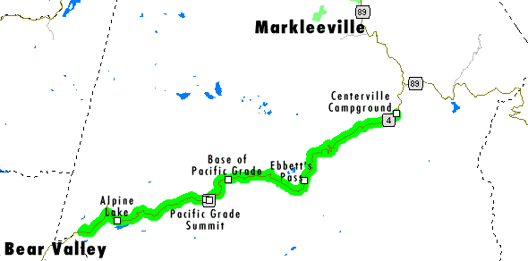
Bear Valley to Markleeville (sort of)
and back!
September 20, 1998
Want to find a way to get in lots of climbing without putting in a whole lot of miles?
Want to find out which is stronger...your knees or your frame? Want to
emulate that feeling of "free fall" that's typically left to downhill mountain
bike racers? Then this is the ticket!
This is a 60-mile out-and-back that takes you through some of the most interesting and
breathtaking areas you've ever seen. Highway 4 is a crazy, one and a half lane road
that meanders past many lakes, streams, a couple waterfalls, and some of the most
spectacular vistas anywhere. |
 |
 |
 |
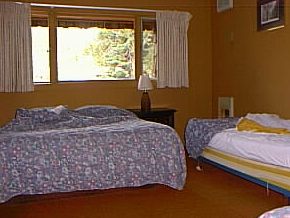
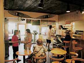
| The left picture is the one of the beautiful rooms at the Red Dog Lodge in
Bear Valley (209) 753-2344. Actually, it's a pretty decent & inexpensive place
to stay...$39/night for 1 or 2 people (2 beds), $49 for 3 (3 beds) [1998
dollars...a bit more expensive now, call for current rates]. Shower and
bathroom facilities are down the hall. One word of warning...all rooms sit above a
bar which, fortunately, closes at midnight (or at least it did the night we were there).
Note: 10/25/09 The Red Dog Lodge no longer exists! Lodging is also available at Alpine Lake Lodge, shown below on the right...don't
have the rates, but the best thing about the place is that you can get a hot shower there
after the ride for just $1.50. At that end of your ride, this will seem like the
bargain of the century! |
 |
 |
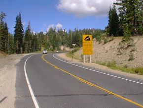
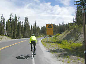
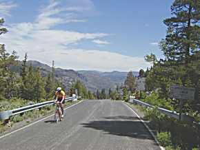
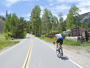
| It doesn't take long to see what you're in for...within the first mile
after leaving Bear Valley, you're climbing an easy grade, the weather's near-perfect, and
then you see the sign. Not just any "trucks use low gears" type
of sign. No, this sign is telling people with anything longer than a Toyota Celica
or with brakes less powerful than a locomotive that they should turn back now,
because there's a 24% grade coming up. |
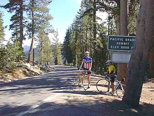 |
This, as they say, is the start of something big. 8050 feet here
(you've started at around 7100 feet in Bear Valley), and you've just passed Mosquito Lake,
one of many small, beautiful spots of sparkling blue water that you just won't find in the
bay area. From here you descend almost exactly 1000 feet into Hermit Valley.
No biggie...except that this all happens in just a mile and a half. 1,000 feet in a
mile and a half. If you need to put this into perspective, consider that Old La
Honda climbs about that much in almost four miles.
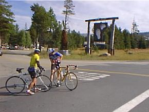
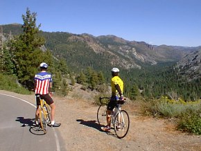
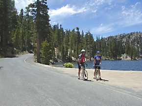
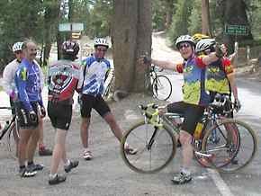
The riders in the picture are Dick Kiser, our resident former steel-is-real now
carbon-fiber convert salesperson, and on the right, Bruno Colchen, our service manager,
both from our Redwood City store. At this point, both were favorably impressed with
the beautiful scenary, fresh air and perhaps even the route I chose...even though I had
warned them repeatedly beforehand of what we were about to get into.
For about half a mile past this point, the road drops off at a relatively easy 8-10%.
And then comes something more commonly found on a mad-dog downhill mountain bike
course...one moment, you're looking forward and there's a road there...the next, it's
gone. Trust me, you will never forget that first hard right-hand turn where the road
suddenly disappears underneath you. You will wonder how it's possible to even pave
something this steep! Dick might have said something like "Oh my God!" but
I remember Bruno's reaction much more vividly...he laughed. The absurdity of
something so steep, and knowing that we were going to be coming back up that same grade
just a few hours later...well, his reaction, while it caught me off-guard, made perfect
sense! |
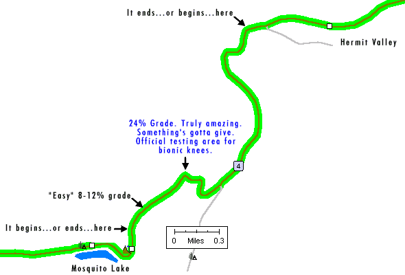
Hermit Valley is a beautiful, quiet place. But that's not the reason you don't want
to leave it- Hermit Valley is the ultimate soup-bowl. Maybe two miles long, with a
big wall on either side. Actually, the climb up to Ebbett's Pass isn't nearly as bad
as you would think...it's one of the easier 1700-foot climbs you'll come across. We
should note here, by the way, that reliable water supplies are always in question...bring
everything you need! |
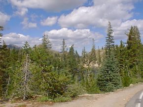
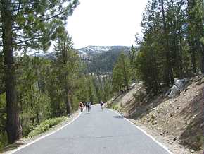
The descent and subsequent climb back up Ebbett's Pass is stunningly beautiful! |
 |
 |
| Is this spectacular or what? We're about half-way down the eastern side of
Ebbett's Pass. |
OK, we just skipped forward...way forward, to the turn-around point at the Centerville
Campground, just prior to joining highway 89 (near Markleeville and Monitor Pass). |
 |
 |
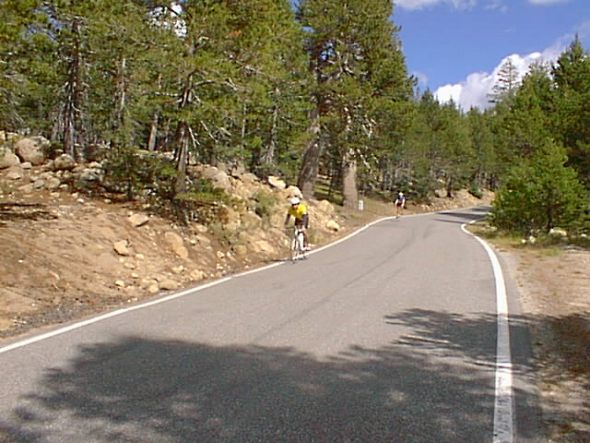
| This is along the bottom of the grade, a couple miles back from the turn-point.
And yes, that's a cyclist heading in the opposite direction. |
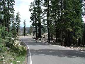
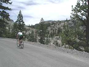
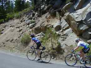
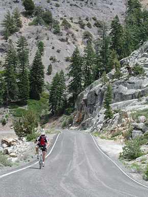
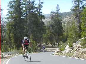
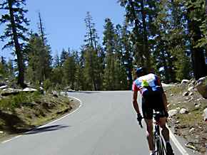
On the east side of the pass, you're going to climb, and climb, and climb, and
climb...it's definitely the longest climb of the ride. But also the most beautiful,
as you can see here. |
 |
 |
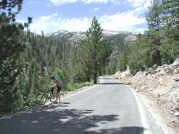
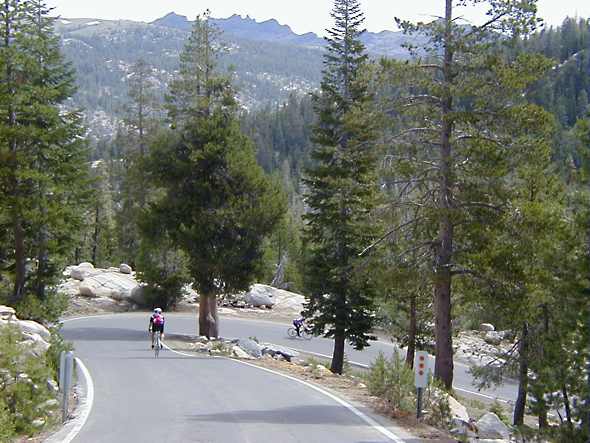
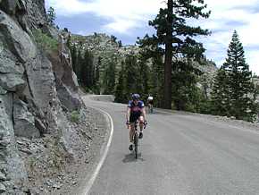
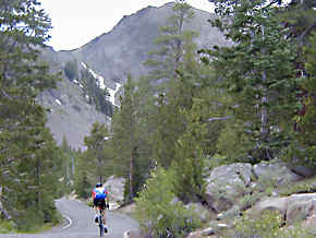
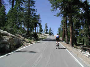
| Way off in the distance there you can see Dick or Bruno, not sure which. This is
one of the more open sections of the climb, and one of the places where you might begin to
reflect on the folly of your endeavor. |
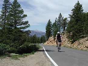
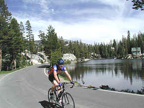
This is the lake you come to just prior to the top of Ebbett's Pass, just one more
example of how pretty it is up at 8000 feet! Of course, the best thing about this
particular lake is that it means you only have about 700 feet of climbing to go! |
 |
 |
| On the left you see the road as you climb past the lake, and on the right
we're looking back at it and the rather awesome clouds that have begun to appear. On
my first ride up this pass, some 25 years ago, I remember leaving Markleeville and looking
up...way up...towards the peak of Ebbett's Pass...where a wild thunderstorm was raging
away. Hey, we were young, stupid and had no future, and didn't give it a second's
thought. Today's weather was, however, a whole lot nicer! |
 |
Last photo of the day. We've manage to survive the incredible climb
up Pacific Grade which was, in the end, not nearly as bad as we'd imagined it to be.
Now we're descending in the area of Lake Alpine, and really looking forward to
those showers! Just under 60 miles, around 7-8,000 feet of climbing...it was a
wonderful ride. --Mike--
PS: Bruno's bike is a 1997 LeMond Chambery OCLV with 39-53 front and 13-26 rear
gearing. Dick rode a 1998 TREK 5000, and had intentions of riding with its stock
12-23 rear cassette; finally, the day before the ride, he relented (under considerable
pressure) and installed a 13-26 as well. My bike, a TREK 1998 Y-Foil 66, was
set up with a 39-53 front and 12-25 rear. I would definitely be willing to admit
that a 12-27 would have been a wiser choice!
Bruno & Dick each carried two water bottles; I used the single main bottle the Y-Foil
allows plus a Camelbak Bandito 50-oz fanny-pack. I would not under any circumstance
attempt this ride with less than two FULL 26oz water bottles and a handful of powerbars
(or equivalent).
|
Organized Ride Options
Hi Mike, I read your story and photos of the Bear Valley to
Markleeville ride you did back in June 01. You did a great job telling the
story and the photos (fantastic, by they way) can only begin to tell the
true beauty of this ride.
This past weekend the Mountain Adventures Seminars Company (www.mtadventure.com/)
out of the "Base Camp" at Bear Valley hosted the 1st annual Bear Valley
BikeFest. Kimi Johnson of M.A.S. did a great job of organizing the event.
This was a weekend long gathering of biking enthusiasts of all kinds.
Saturday offered seminars for beginning and intermediate mtb riders, trials
exhibitions, and an Advanced group ride for mtb'rs. I was going to do the
mtb ride but the consensus at sign-ups was that more folks were opting for
the 77 mile road ride to Markleeville - so I did it! What an excellent ride!
Like you describe in your recount, this is an excellent road ride for the
scenery and for those that want to get in some vertical. The Pacific Grade
is, well..., humbling to say the least. Sunday was followed up with the
advanced mtb ride up to Bear Valley Ski area and back down through some very
nice singletrack (Elusive Trail) back down to town. Everyone had a great
time with tacos and cervesas rounding out the day at Miguel's afterwards.
I mention this Bike Fest to you as it is was the first annual of what could
be a very good thing. Though the attendance was light, I'm sure everyone -
myself included - will return next year. Perhaps you could spread the word
with your contacts in the biking community. This seems like a great fit for
the third weekend of Sept. in that it is typically a "slow season" period
and it really injects some revenue into the local businesses. Besides, why
not get together with biking buddies for a great weekend in the Sierras!
Sincerely,
Bob Rynd
Biking and outdoor enthusiast from Fremont |
| Check these links for lodging at Bear
Valley and Lake Alpine.
Ebbetts
Pass and Pacific Grade were revisited in June
2001, with even more photos!
And if this ride isn't enough for you, check out our
trip over Sonora Pass!
We also have info from
CalTrans showing when this, and several other Trans-Sierra passes, have closed and
re-opened each year.
Overview of the various rides on this site-
Last updated
10/30/09
 since 05/06/05
|
|
Ebbetts Pass & Pacific Grade revisited
Check here for our
original report on Ebbetts Pass! Not as many photos, but includes
some maps not found here.
 |
| June 10th, 2001...yet
another glorious day for climbing hills in the Sierras!
Ebbetts is, to me, the most beautiful of all the trans-Sierra
passes. Sure,
Tioga Pass is
stunning for its dramatic granite walls and views of the Yosemite
Valley, but nothing beats Ebbetts Pass & Pacific Grade for its
uncrowded 1.5 lane roads, frequent babble of creeks, giant
redwoods and a sense that you're experiencing something very
special. Accompanying me on this ride were Brian Krause from
our Redwood City store and Mike M. --Mike-- |
 |
 |
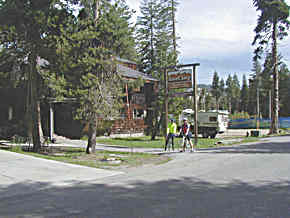
| It used to be called Red Dog Lodge,
but now it's Base Camp. Same great rates (in season
weekends, $60/2 people, plus $10 each additional). |
The cafe at the fancier
lodge just down the road, where we had breakfast. |
 |
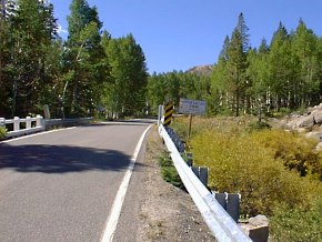
 |
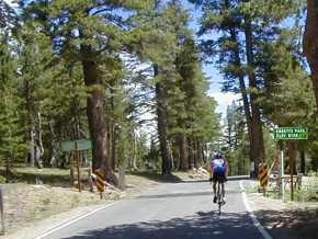
| Shortly after you start climbing
(which is within a couple hundred feet of starting to ride!) you
get the obligatory photo op...24% grade ahead! |
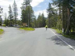
After winding around and
climbing a bit you reach the last outpost of civilization, Lake
Alpine. If you don't like steep roads, turn back now. |
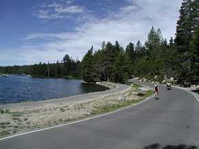 |
 |
| Another view of Alpine Lake...very
pretty! |
The first switchback descending
Pacific Grade. |
 |
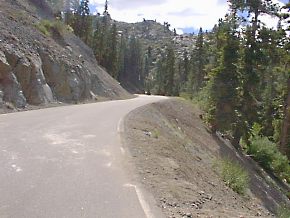
| What, exactly, does a 24%
grade look like? Not as steep as it feels! This is the
spot where, two years ago, Bruno started laughing as the road
curved down and away from him. |
 |
 |
| 1,000 feet below Pacific Grade is
Hermit Valley, a very pleasant (but short) piece of flat road. |
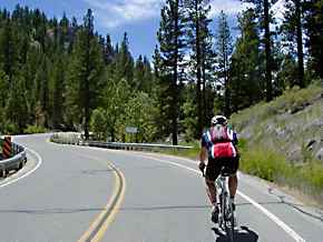
But this ride isn't about flat roads,
is it? Out of Hermit Valley you climb about 2,000 feet to
Ebbetts Pass. |
 |
 |
| The highpoint of our ride, Ebbetts
Pass, as Brian hits the summit first. |
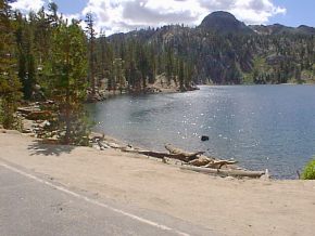
Kinney Reservoir, a mile or two below
(east) of Ebbetts Pass, finds Brian & Mike all smiles &
ready to go. |
 |
 |
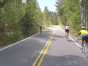
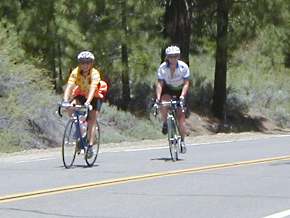
| On the way down Ebbetts
Pass we saw quite a few cyclists coming up the hill, most of them
training for the Markleeville Death Ride about a month later. |
 |
 |
| Down, down, down... |
...until you level out into a valley
that used to be a bustling mining community. Not anymore! |
 |
 |
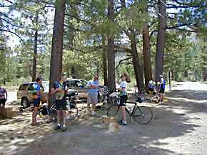
| Wolf Creek Campground,
our turnaround point and also today's base camp for a group
training for the Markleeville Death Ride. They had just done
both sides of Monitor Pass, and were getting ready for an assault
on Ebbetts. Interestingly, women outnumbered men in this
group. |
 |
 |
| On the way back we cross Silver
Creek, our constant companion on the way up Ebbetts. |
If not for an occasional Bots Dot on
the highway, you could easily think it's 1920 in these
parts! |
 |
 |
| More DeathRide trainees as we start
to climb. |
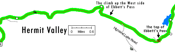
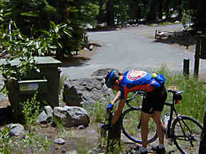
Out of water? There seems to be
only one campground on the east side of Ebbetts with running
water...I'd strongly suggest filling up! |
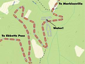
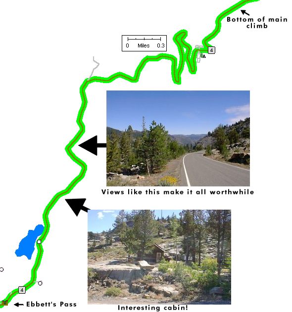
The map above shows the location the campground where we found
the water.
Basically, it's on the east side of the pass, so you can get water
there on your way while heading west. Look for the first
Silver Creek crossing on the way up, just after the climb starts
to get going.
Originally I didn't have this map posted, but
today (06/23/01) I got two emails from different people,
requesting more info on the location of the water!
You might also consider one of the water bottles
with a built-in filter (so you can get water safely from any of
the many creeks you'll come across).
|
This is what it's all about. Trees, granite,
waterfalls, nice pavement, picture-perfect day (temps in the
low-60s to mid-80s), light breeze and friendly cyclists. Oh
yeah, and a nice hill to climb to! |
 |
 |
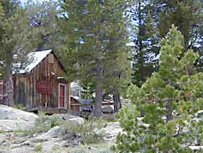
| At least somebody's found
a home in Shangri-La! Probably not so easy to live here in
the winter though. |
 |
 |
| Just a mile or so to go to the top... |
...where we find quite a crowd at
Ebbetts Pass! |
 |
 |
| Descending from Ebbetts into Hermit
Valley at high speed isn't the easiest time to take
pictures. |
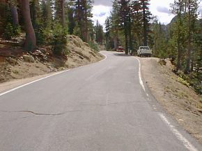
But neither is climbing up Pacific
Grade. This is the very start of the climb, just past the
creek crossing. |
 |
 |
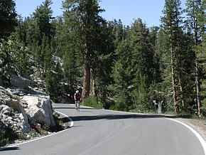
| So what's the lowest gear
on your bike? Brian had a 39/25, while I was using a
39/27. Yes, I was using the 27 at times! Curiously,
shortly after these photos were taken Brian was asking if we had
27s in stock. |
|
|
 |
| Rounding the final corner to the
Pacific Grade summit. You've just climbed 1,000 feet in just over
a mile. Compare that to Highway 84, where you climb 1,000
feet in over three miles. |
Mosquito Lake is appropriately named,
but I wonder if sucking on my Cytomax-enriched blood might have
created a new super-breed of high-speed endurance Mosquitoes? |
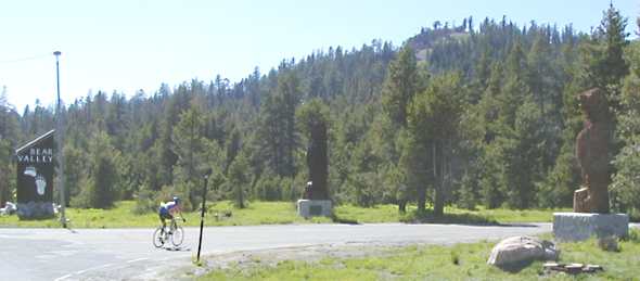 |
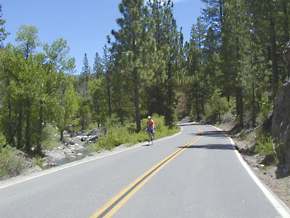
| Heading back to Base Camp
at the end of the ride! About 57 miles, 7700 feet of
climbing. Not nearly as tough as the Sequoia Double Metric
century the week before, nor as challenging as Sonora Pass coming
up in two weeks. But definitely a fun ride, worth the three
hours of driving to get there.
Tech notes: Mike M was riding a TREK 5500
with Campy triple, Brian Krause a TREK 5200 with a 39/53 front and
12/25 rear (to be replaced by a 12/27 for the next mountainous
ride!) and me with a TREK 5500 with 39/53 and a 12/27 rear.
I felt entirely comfortable with my gearing, but then I like
really steep hills, and prefer standing to sitting when the going
gets tough.
For the photos, I actually brought both of my
digital cameras, my standard take-photos-as-you-ride Olympus 450Z,
as well as the much higher resolution Olympus 3000. All
shots taken while riding were done with the 450Z, while most of
those where I had time to stop and set up the shot were done with
the 3000. The 3000 is capable of absolutely stunning photos,
with enlargements to 12x18 entirely reasonable. Over 150
photos were taken, which is one of the reasons it's taken so long
to get this page up...an awful lot of shots to go through and
process! --Mike--
|
| |
|
|
|
 Select & join email lists