Trans-Sierra road information
|
The following info (not the maps, just the road closure information) is shamelessly
stolen from CalTrans's website at http://www.dot.ca.gov/hq/roadinfo/clsdates.htm.
The links will take you directly to the page CalTrans maintains with
the latest info for that particular road.
We list the info here so you can get an idea of when the various trans-sierra passes are
closed. Of course, just because a road is open doesn't mean it's
rideable!!!
Generally, the high-sierra weather becomes extremely unpredictable by October, and I'd
highly recommend a sharp eye on weather reports if you intend to try to "squeeze one
in" before Winter hits. In the other direction, it's usually "safe"
to assume reasonable weather conditions when the roads are re-opened in Spring, but keep
in mind that heavy runoff could make the roads extremely wet, and a slight breeze off snow
piles high on the sides of the road could make things very unpleasant, even on a
relatively warm day. |
The dates and times of closures in
recent years are listed by route in the tables below.
(We've got a ride
report and photos on this route)
OPEN AS OF 5/03/01! There's also info here
on snow levels and temp at the pass.
|
|
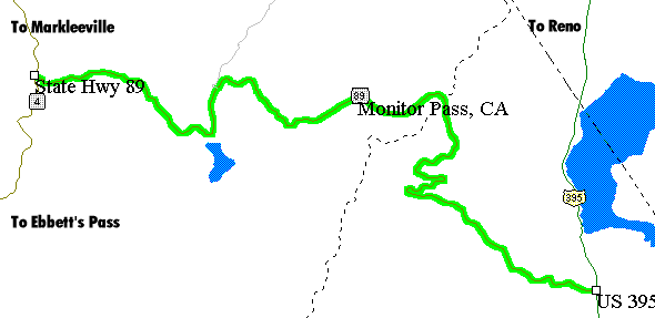
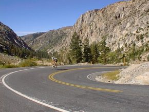
This has just got to be one of the most spectacular 50 mile
rides in existence, with views of lakes, mountains, valleys, clouds...it's
beyond belief, and definitely the most scenic section of the infamous
Markleeville Death Ride.
Full Winter Closure: [ 0.5 Mile East of Junction Sr 207 to the Junction of
SR 4 ] |
| Closure / Reopening |
1993/94 |
1994/95 |
1995/96 |
1996/97 |
1997/98 |
1998/99 |
| SR - 4 |
10/4 to 5/9 |
11/4 to 6/15 |
12/11 to 5/10 |
11/16 to 5/9 |
12/03 to 5/22 |
11/06 to 5/14 |
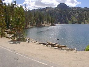
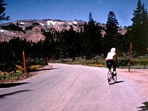
State Route 89 Monitor Pass
OPEN AS OF 03/23/01! Info
on snow & temps here.
 |
 |
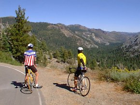
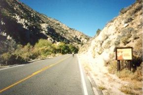
Climbing from the Markleeville side |
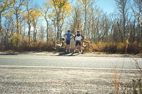
Two unidentified riders at the top |
Full Winter Closure: [ From the Junction of US 395 to the Junction of SR 4
]
| Closure / Reopening |
1993/94 |
1994/95 |
1995/96 |
1996/97 |
1997/98 |
1998/99 |
| SR - 89 |
12/11 to 3/11 |
11/15 to 4/28 |
12/12 to 4/3 |
12/21 to 5/2 |
12/08 to 5/15 |
11/28 to 4/15 |
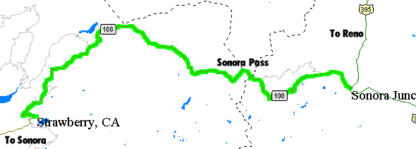
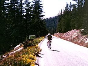
(We've got a ride report and photos on
this route)
OPEN AS OF 5/03/01! Info on snow level
and temps near top here.
|
|
The new and the old. On the left is Dick Kiser climbing
up one of the steeper sections on the west side of Sonora Pass in 1998.
On the right is Mike climbing the east side in 1987!
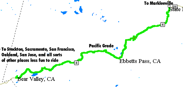
Full Winter Closure: [ From 6 Miles East of Strawberry to 7 Miles West of
Junction US 395 ] |
| Closure / Reopening |
1993/94 |
1994/95 |
1995/96 |
1996/97 |
1997/98 |
1998/99 |
| SR - 108 |
12/11 to 3/25 |
11/15 to 4/28 |
12/11 to 5/20 |
10/29 to 5/9 |
12/01 to 5/22 |
11/06 to 5/14 |
|
|
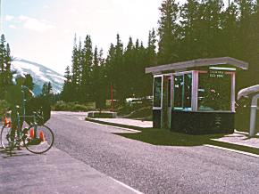
Climbing Tioga Pass from the west side in the mid-1980s.
This is the highest paved Sierra crossing at 9940 feet (some maps list it at
just over 10,000, but the summit toll booth in the photo on the right tells
you you're going to have to hoof it another 60 feet up the hillside if you
want to get to that magical 10,000 foot elevation).
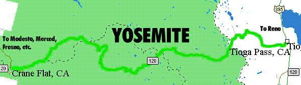
Full Winter Closure: [ From Crane Flat to the 5 Miles West of the Junction
of US 395 ]
|
| Closure / Reopening |
1993/94 |
1994/95 |
1995/96 |
1996/97 |
1997/98 |
1998/99 |
| SR - 120 |
11/11 to 5/25 |
11/10 to 6/30 |
11/25 to 5/31 |
11/5 to 6/13 |
12/01 to 7/01 |
11/12 to 5/28 |
|
Check here for an overview of the various
different rides on our website.
Last updated
05/06/05 |
[menunew.htm]
|